MyTopo
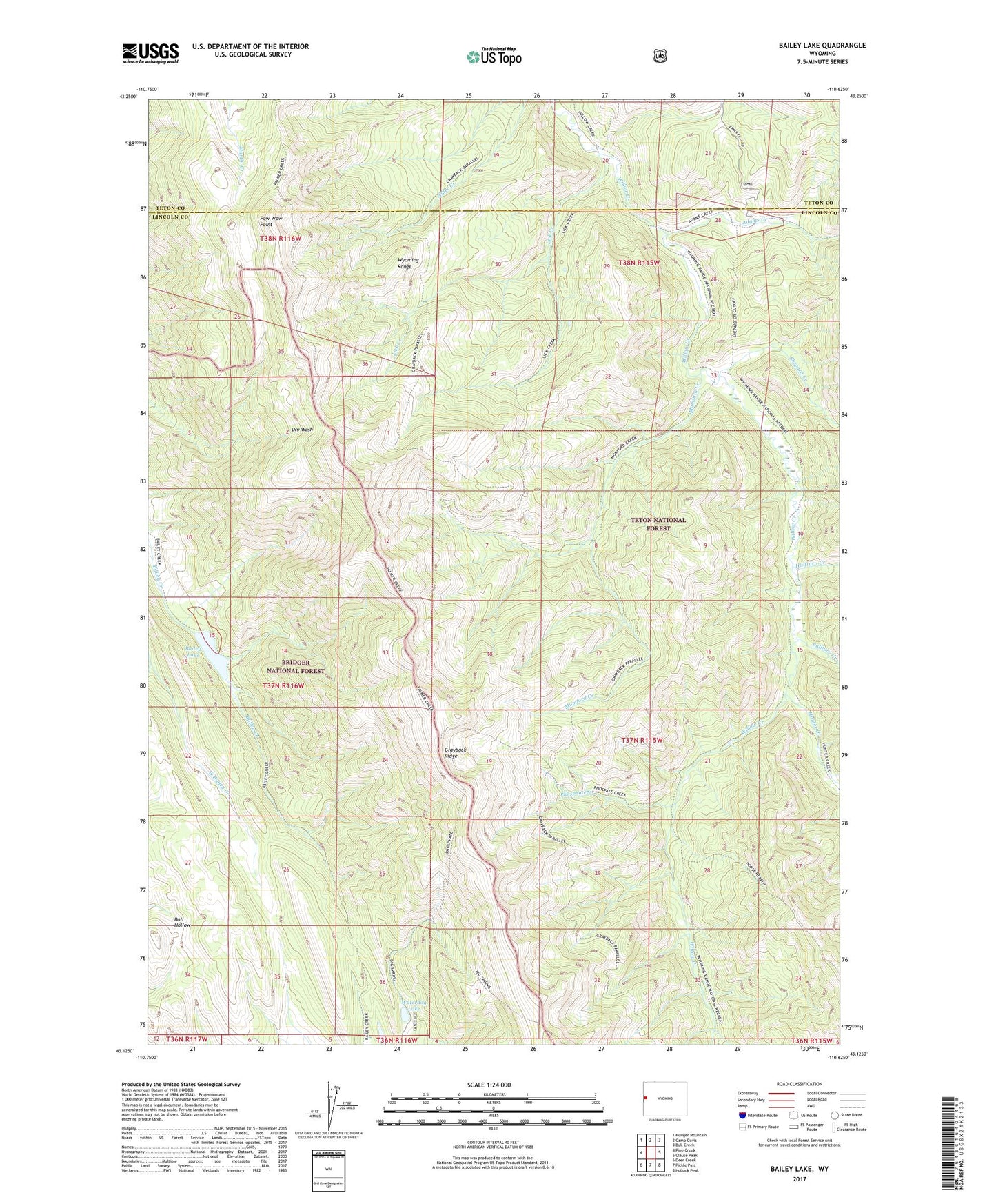
Bailey Lake Wyoming US Topo Map
Couldn't load pickup availability
Also explore the Bailey Lake Forest Service Topo of this same quad for updated USFS data
2021 topographic map quadrangle Bailey Lake in the state of Wyoming. Scale: 1:24000. Based on the newly updated USGS 7.5' US Topo map series, this map is in the following counties: Lincoln, Teton. The map contains contour data, water features, and other items you are used to seeing on USGS maps, but also has updated roads and other features. This is the next generation of topographic maps. Printed on high-quality waterproof paper with UV fade-resistant inks.
Quads adjacent to this one:
West: Pine Creek
Northwest: Munger Mountain
North: Camp Davis
Northeast: Bull Creek
East: Clause Peak
Southeast: Hoback Peak
South: Pickle Pass
Southwest: Deer Creek
This map covers the same area as the classic USGS quad with code o43110b6.
Contains the following named places: Adams Creek, Bailey Lake, Budd Prospect Mine, Fullturn Creek, Halfturn Creek, Hunter Creek, Lick Creek, Mumford Creek, Phosphate Creek, Pow Wow Point, Rimrock Ranch, Shepard Creek, Waterdog Lake