MyTopo
Pine Creek Wyoming US Topo Map
Couldn't load pickup availability
Also explore the Pine Creek Forest Service Topo of this same quad for updated USFS data
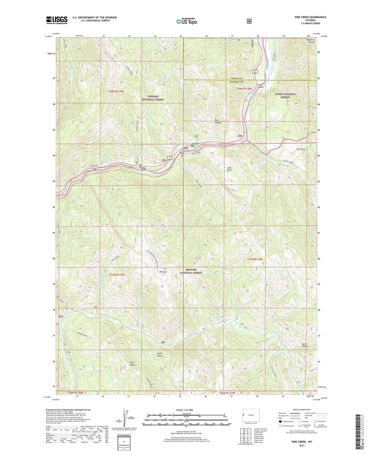
2021 topographic map quadrangle Pine Creek in the state of Wyoming. Scale: 1:24000. Based on the newly updated USGS 7.5' US Topo map series, this map is in the following counties: Lincoln, Teton. The map contains contour data, water features, and other items you are used to seeing on USGS maps, but also has updated roads and other features. This is the next generation of topographic maps. Printed on high-quality waterproof paper with UV fade-resistant inks.
Quads adjacent to this one:
West: Ferry Peak
Northwest: Observation Peak
North: Munger Mountain
Northeast: Camp Davis
East: Bailey Lake
Southeast: Pickle Pass
South: Deer Creek
Southwest: Stewart Peak
This map covers the same area as the classic USGS quad with code o43110b7.
Contains the following named places: Aspen Hollow, Bailey Creek, Bull Hollow, Cabin Creek, Cow Camp Creek, Davis Claim, Dry Wash, East Elbow Campground, East Table Creek, East Table Creek Campground, Elbow Campground, Elk Mountain, Fire Box Creek, Iron Rim Creek, Keyser Creek, Lake Gulch, Little Greys River, Martin Creek, McCain Creek, Pine Bar, Pine Bar Diggings, Pine Creek, Pole Canyon, Roos Creek, Skull Creek, Squirrel Creek, Station Creek, Station Creek Campground, Trail Creek, West Bailey Creek, West Table Creek, West Table Creek Boat Ramp, Whiskey Creek