MyTopo
Castle Rock Wyoming US Topo Map
Couldn't load pickup availability
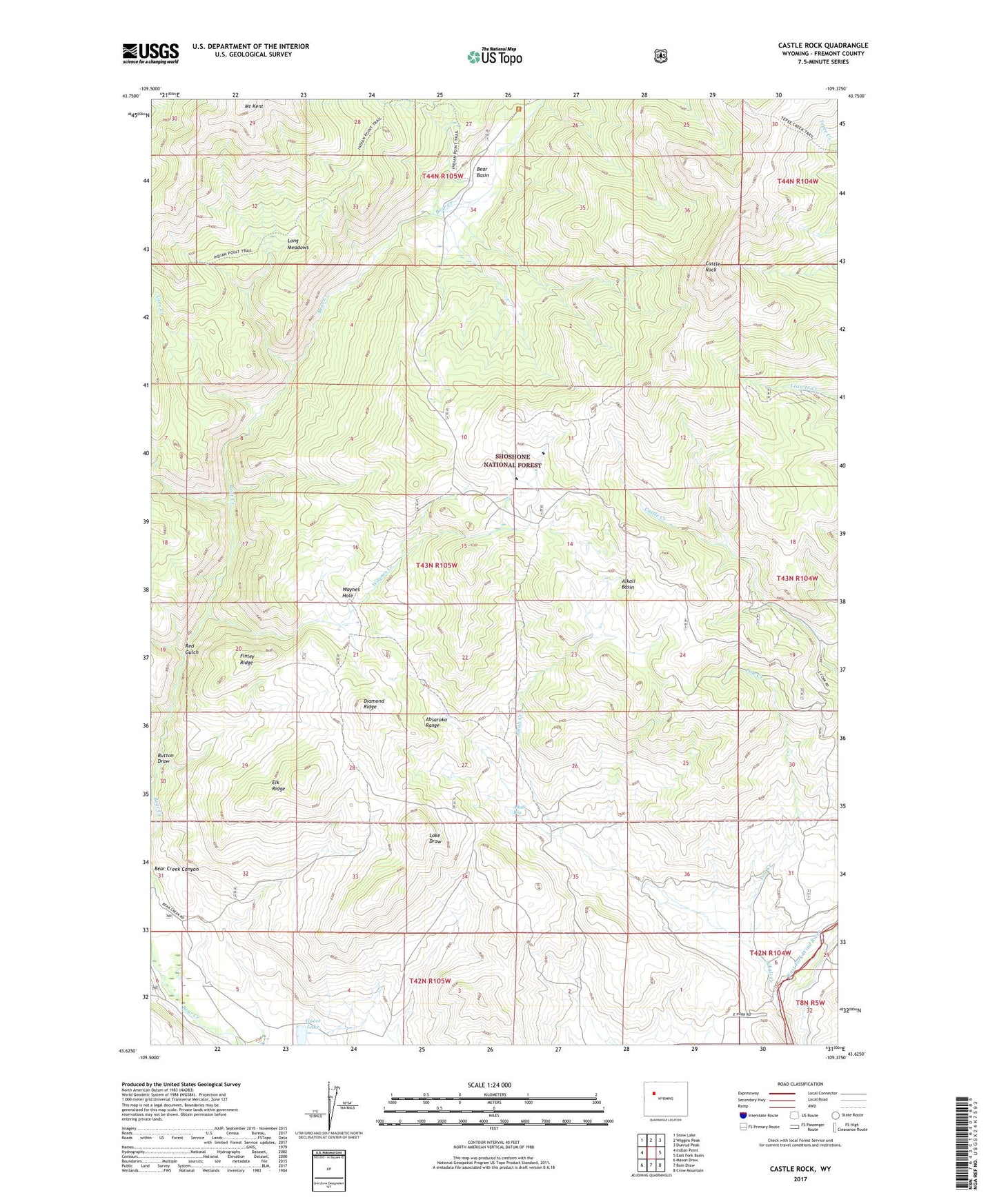
2021 topographic map quadrangle Castle Rock in the state of Wyoming. Scale: 1:24000. Based on the newly updated USGS 7.5' US Topo map series, this map is in the following counties: Fremont. The map contains contour data, water features, and other items you are used to seeing on USGS maps, but also has updated roads and other features. This is the next generation of topographic maps. Printed on high-quality waterproof paper with UV fade-resistant inks.
Quads adjacent to this one:
West: Indian Point
Northwest: Snow Lake
North: Wiggins Peak
Northeast: Dunrud Peak
East: East Fork Basin
Southeast: Crow Mountain
South: Bain Draw
Southwest: Mason Draw
Contains the following named places: Alkali Basin, Alkali Bog, Alkali Creek, Arm Group Mine, Bain Creek, Bear Basin, Bear Creek Canyon, Button Draw, Castle Rock, Cave Creek, Diamond Ridge, East Fork Elk Winter Pasture, East Fork Wind River Mine, Elk Ridge, Finley Ridge, Flying T Ranch, Goose Lake, Gray Ghost Group Mine, Horse Draw, Long Meadows, Mount Kent, Pole Creek, Pole Creek Group Mine, Pole Creek Number Two Mine, Red Gulch, Tepee Creek Trail, Waynes Creek, Waynes Creek Range Experiment Station, Waynes Hole