MyTopo
Mason Draw Wyoming US Topo Map
Couldn't load pickup availability
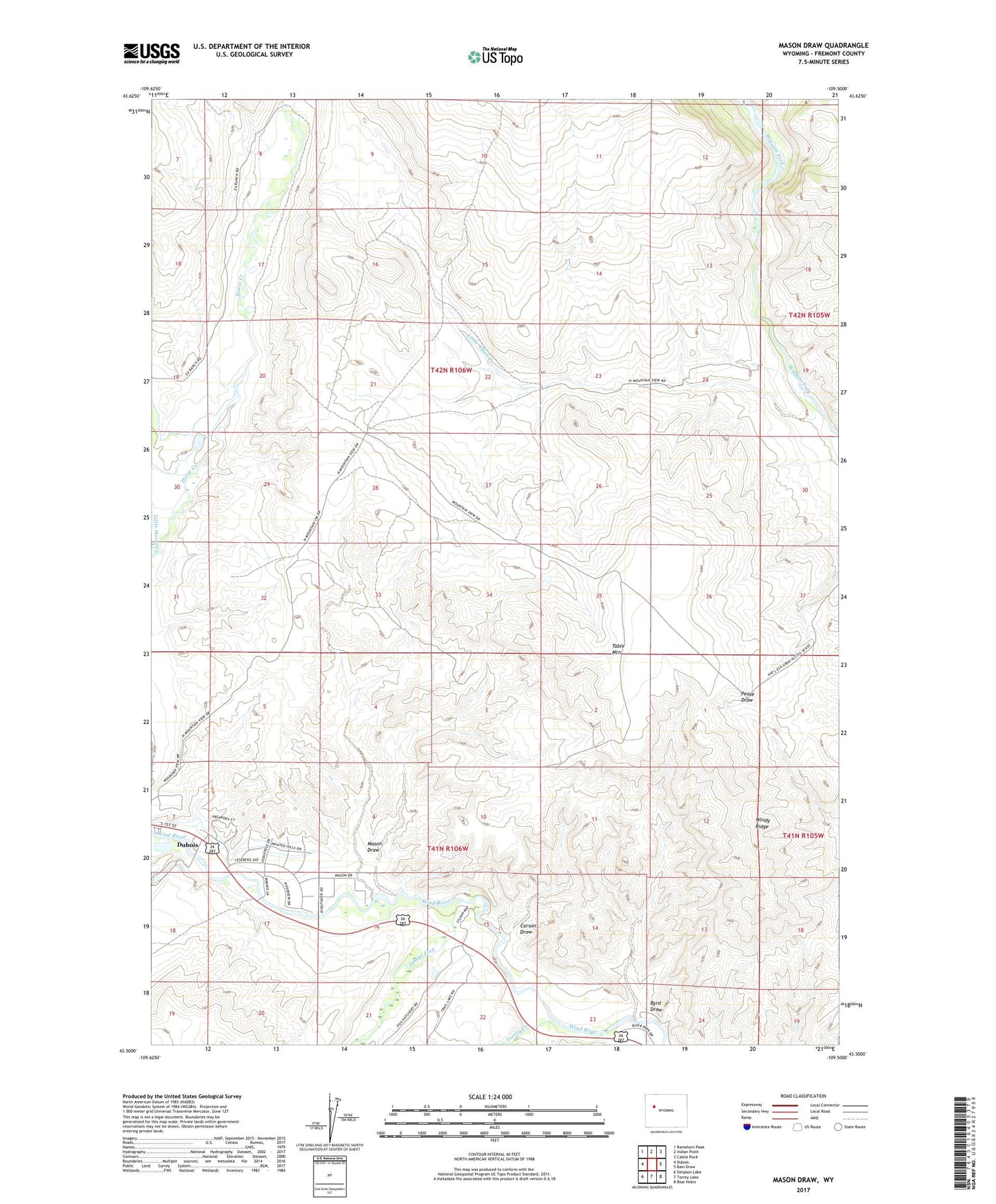
2021 topographic map quadrangle Mason Draw in the state of Wyoming. Scale: 1:24000. Based on the newly updated USGS 7.5' US Topo map series, this map is in the following counties: Fremont. The map contains contour data, water features, and other items you are used to seeing on USGS maps, but also has updated roads and other features. This is the next generation of topographic maps. Printed on high-quality waterproof paper with UV fade-resistant inks.
Quads adjacent to this one:
West: Dubois
Northwest: Ramshorn Peak
North: Indian Point
Northeast: Castle Rock
East: Bain Draw
Southeast: Blue Holes
South: Torrey Lake
Southwest: Simpson Lake
This map covers the same area as the classic USGS quad with code o43109e5.
Contains the following named places: Byrd Draw, Carson Draw, E A Ranch, Fish Ranch, Jakeys Fork, Jones Ranch, Leseburg Ditch, Little Alkali Creek, Little Horse Creek, Mason Draw, Rocking Chair Ranch, Table Mountain, Torrey Creek, Windy Ridge