MyTopo
Bain Draw Wyoming US Topo Map
Couldn't load pickup availability
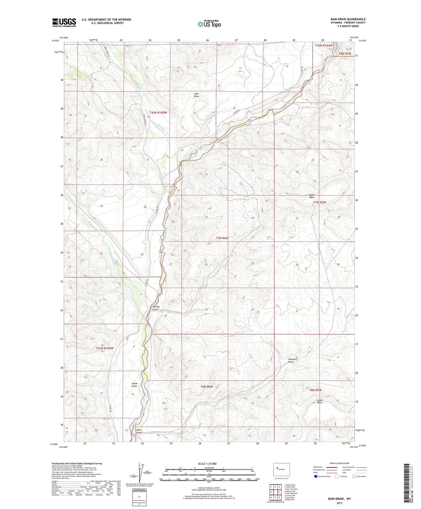
2021 topographic map quadrangle Bain Draw in the state of Wyoming. Scale: 1:24000. Based on the newly updated USGS 7.5' US Topo map series, this map is in the following counties: Fremont. The map contains contour data, water features, and other items you are used to seeing on USGS maps, but also has updated roads and other features. This is the next generation of topographic maps. Printed on high-quality waterproof paper with UV fade-resistant inks.
Quads adjacent to this one:
West: Mason Draw
Northwest: Indian Point
North: Castle Rock
Northeast: East Fork Basin
East: Crow Mountain
Southeast: Wilderness
South: Blue Holes
Southwest: Torrey Lake
This map covers the same area as the classic USGS quad with code o43109e4.
Contains the following named places: Abernathy Deposit Number Four Mine, Abernathy Deposit Number Three Mine, Bain Draw, Bain Place, Bear Creek, Bitterroot Number 1 Dam, Bitterroot Number 1 Reservoir, Circle Ditch, Double Diamond Number 1 Reservoir, Double Diamond Number 1 Reservoir Dam, Double Diamond Ranch, Finley Ranch, Harvey Draw, Lake Draw, Lower Table, Pease Draw, Spear Creek, Spring Creek, Upper Table, Wiggins Fork, Windmill Draw