MyTopo
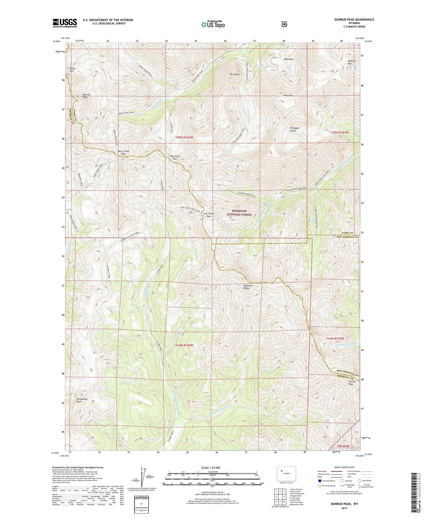
Dunrud Peak Wyoming US Topo Map
Couldn't load pickup availability
Also explore the Dunrud Peak Forest Service Topo of this same quad for updated USFS data
2021 topographic map quadrangle Dunrud Peak in the state of Wyoming. Scale: 1:24000. Based on the newly updated USGS 7.5' US Topo map series, this map is in the following counties: Fremont, Park, Hot Springs. The map contains contour data, water features, and other items you are used to seeing on USGS maps, but also has updated roads and other features. This is the next generation of topographic maps. Printed on high-quality waterproof paper with UV fade-resistant inks.
Quads adjacent to this one:
West: Wiggins Peak
Northwest: Mount Burwell
North: Francs Peak
Northeast: Dick Creek Lakes
East: Twin Peaks
Southeast: Monument Peak
South: East Fork Basin
Southwest: Castle Rock
This map covers the same area as the classic USGS quad with code o43109g3.
Contains the following named places: Absaroka Trail, Bald Mountain, Bear Creek Pass, Bryan Mine, Cascade Creek, Cascade Creek Trail, Coal Chute Pass, County Peak, Dunrud Peak, East Fork East Fork Wind River, East Fork Pass, East Fork Trail, Horse Creek, Kirwin District Mine, Kirwin Mine, Mineral Mountain, Mount Sniffel, Name Creek, Ninemile Trail, Pickwick Mine, Smuggler Gulch Trail, Smuggler Mine, Spar Mountain, Steamboat Rock, Tumlum Mine, Wolf Shaft