MyTopo
Cedar Canyon Wyoming US Topo Map
Couldn't load pickup availability
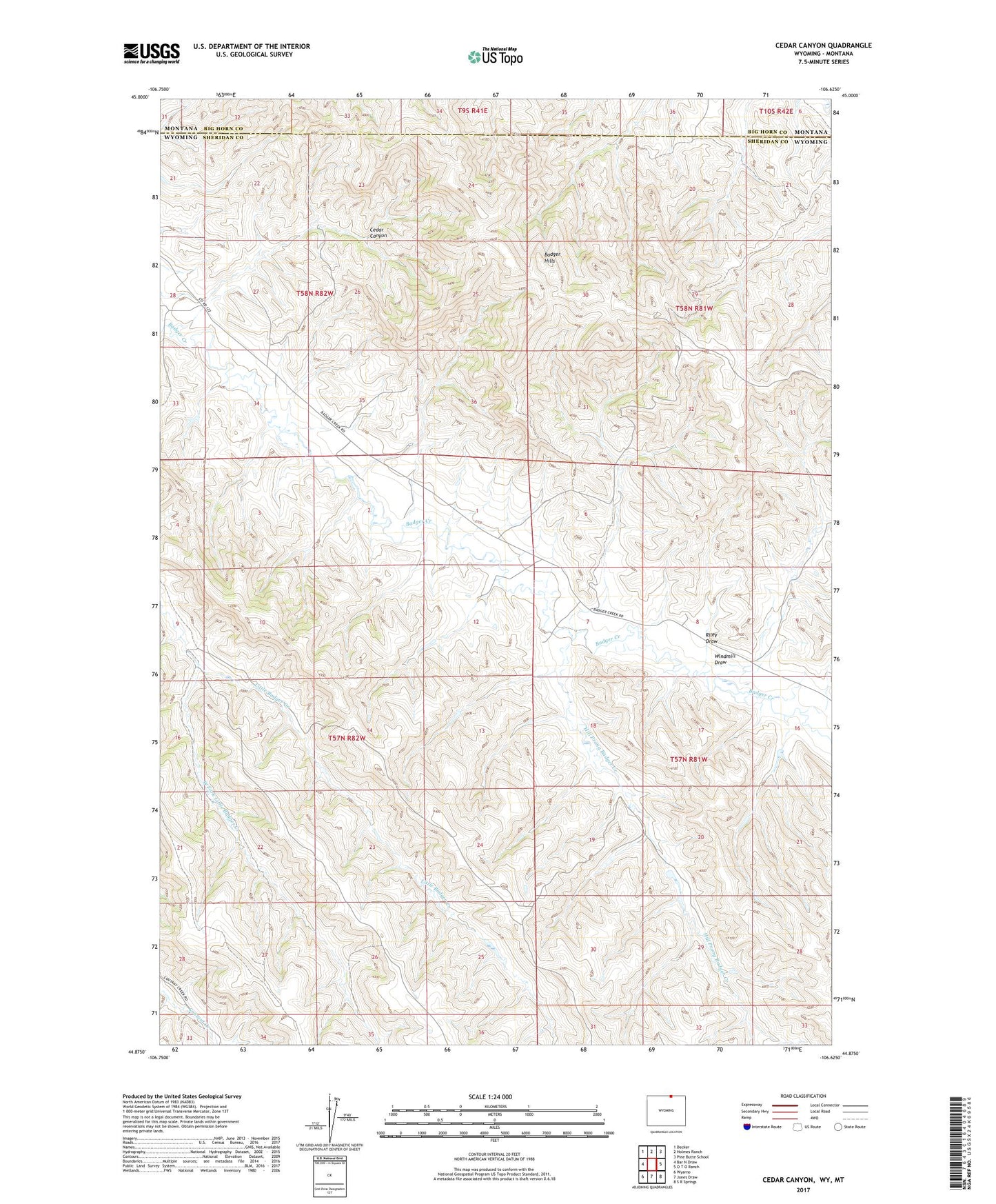
2021 topographic map quadrangle Cedar Canyon in the states of Wyoming, Montana. Scale: 1:24000. Based on the newly updated USGS 7.5' US Topo map series, this map is in the following counties: Sheridan, Big Horn. The map contains contour data, water features, and other items you are used to seeing on USGS maps, but also has updated roads and other features. This is the next generation of topographic maps. Printed on high-quality waterproof paper with UV fade-resistant inks.
Quads adjacent to this one:
West: Bar N Draw
Northwest: Decker
North: Holmes Ranch
Northeast: Pine Butte School
East: O T O Ranch
Southeast: S R Springs
South: Jones Draw
Southwest: Wyarno
This map covers the same area as the classic USGS quad with code o44106h6.
Contains the following named places: Badger Hills, Hill Prong Badger Creek, N X Bar Ranch, Riley Draw, West Fork Little Badger Creek, Windmill Draw