MyTopo
Circle Ridge Wyoming US Topo Map
Couldn't load pickup availability
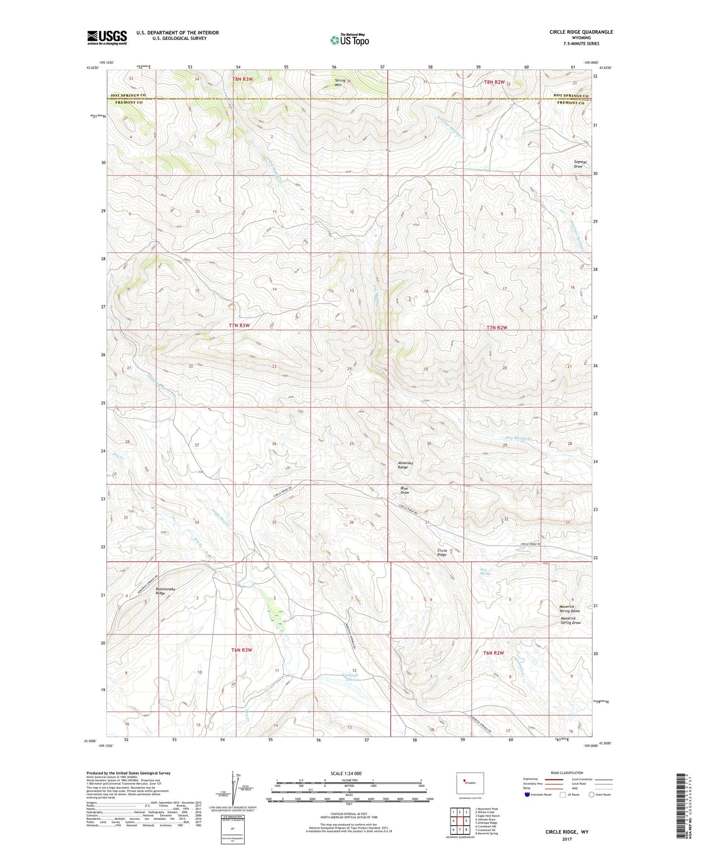
2021 topographic map quadrangle Circle Ridge in the state of Wyoming. Scale: 1:24000. Based on the newly updated USGS 7.5' US Topo map series, this map is in the following counties: Fremont, Hot Springs. The map contains contour data, water features, and other items you are used to seeing on USGS maps, but also has updated roads and other features. This is the next generation of topographic maps. Printed on high-quality waterproof paper with UV fade-resistant inks.
Quads adjacent to this one:
West: Johnson Draw
Northwest: Monument Peak
North: Willow Creek
Northeast: Eagle Nest Ranch
East: Antelope Ridge
Southeast: Maverick Spring
South: Crowheart NE
Southwest: Crowheart NW
This map covers the same area as the classic USGS quad with code o43109e1.
Contains the following named places: Circle Ridge, Circle Ridge Anticline Number Five Mine, Circle Ridge Anticline Number One Mine, Circle Ridge Anticline Number Three Mine, Circle Ridge Oil Field, Collins Place, Kanaugh Lake, Little Dry Creek, Maverick Spring Dome, Porter Cabin Cow Camp, Rattlesnake Ridge, Red Spring, Spring Mountain, Vincent Cabin