MyTopo
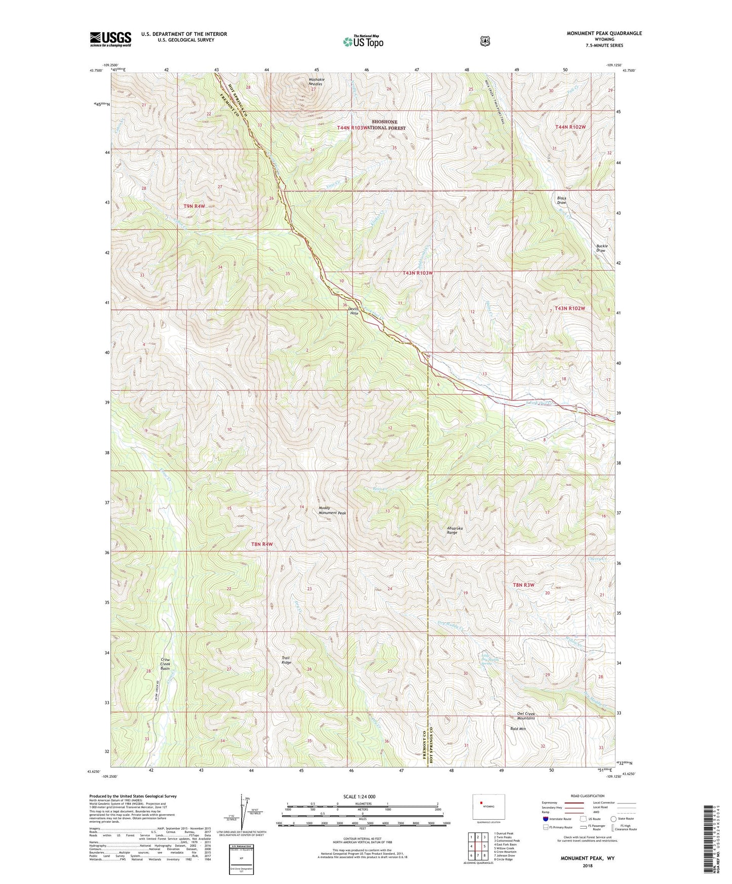
Monument Peak Wyoming US Topo Map
Couldn't load pickup availability
Also explore the Monument Peak Forest Service Topo of this same quad for updated USFS data
2021 topographic map quadrangle Monument Peak in the state of Wyoming. Scale: 1:24000. Based on the newly updated USGS 7.5' US Topo map series, this map is in the following counties: Fremont, Hot Springs. The map contains contour data, water features, and other items you are used to seeing on USGS maps, but also has updated roads and other features. This is the next generation of topographic maps. Printed on high-quality waterproof paper with UV fade-resistant inks.
Quads adjacent to this one:
West: East Fork Basin
Northwest: Dunrud Peak
North: Twin Peaks
Northeast: Cottonwood Peak
East: Willow Creek
Southeast: Circle Ridge
South: Johnson Draw
Southwest: Crow Mountain
This map covers the same area as the classic USGS quad with code o43109f2.
Contains the following named places: Additional Creek, Bald Mountain, Bear Creek, Black Draw, Buckle Draw, Cabin Creek, Crow Creek Basin, Devils Hole, Fall Creek, Hulse Creek, Klicker Creek, Little Dry Muddy Spring, Muddy Monument Peak, Needle Creek, Trail Ridge, Vass Creek, Washakie Needles, Willow Creek