MyTopo
Willow Creek Wyoming US Topo Map
Couldn't load pickup availability
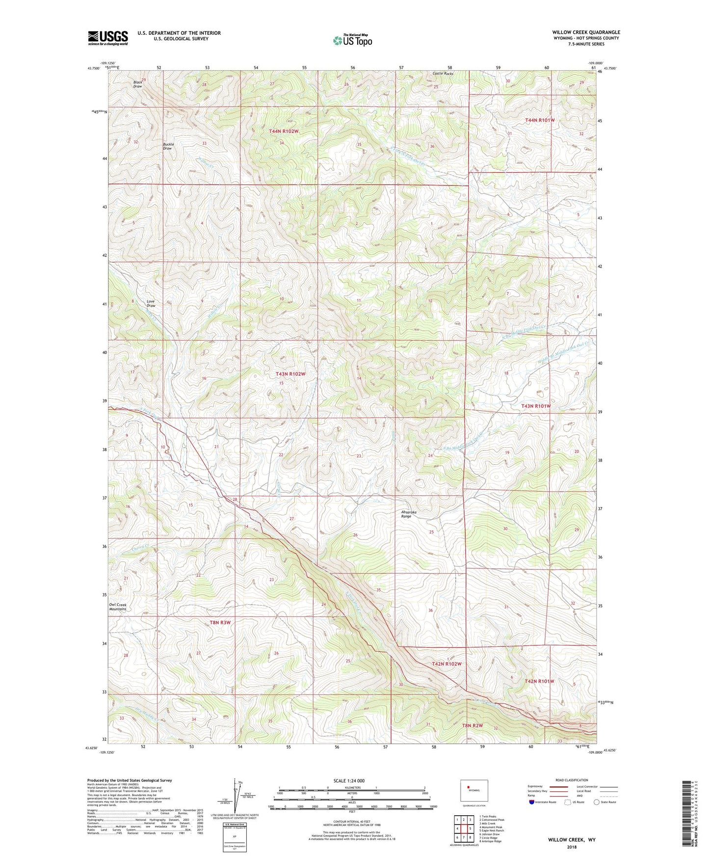
2021 topographic map quadrangle Willow Creek in the state of Wyoming. Scale: 1:24000. Based on the newly updated USGS 7.5' US Topo map series, this map is in the following counties: Hot Springs. The map contains contour data, water features, and other items you are used to seeing on USGS maps, but also has updated roads and other features. This is the next generation of topographic maps. Printed on high-quality waterproof paper with UV fade-resistant inks.
Quads adjacent to this one:
West: Monument Peak
Northwest: Twin Peaks
North: Cottonwood Peak
Northeast: Milk Creek
East: Eagle Nest Ranch
Southeast: Antelope Ridge
South: Circle Ridge
Southwest: Johnson Draw
This map covers the same area as the classic USGS quad with code o43109f1.
Contains the following named places: Cherry Creek, Curry Creek, Love Draw, North Branch Middle Fork Owl Creek, Rock Creek, Slab Creek, Willow Creek