MyTopo
Clause Peak Wyoming US Topo Map
Couldn't load pickup availability
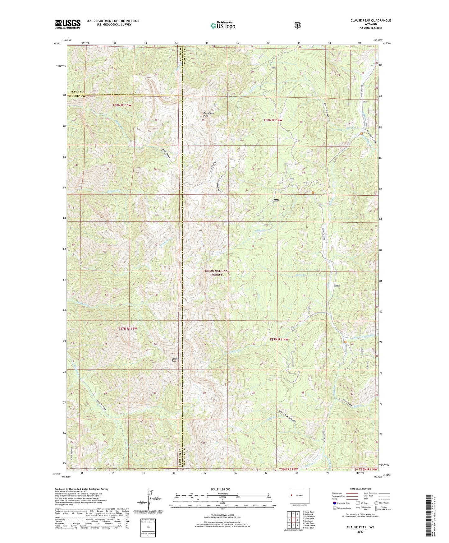
2021 topographic map quadrangle Clause Peak in the state of Wyoming. Scale: 1:24000. Based on the newly updated USGS 7.5' US Topo map series, this map is in the following counties: Sublette, Lincoln, Teton. The map contains contour data, water features, and other items you are used to seeing on USGS maps, but also has updated roads and other features. This is the next generation of topographic maps. Printed on high-quality waterproof paper with UV fade-resistant inks.
Quads adjacent to this one:
West: Bailey Lake
Northwest: Camp Davis
North: Bull Creek
Northeast: Granite Falls
East: Bondurant
Southeast: Noble Basin
South: Hoback Peak
Southwest: Pickle Pass
Contains the following named places: Bondurant Creek, Burnt Creek, Cabin Creek, Clause Creek, Clause Peak, Cliff Creek Mine, Gibbs Creek, Kerr Creek, Little Cliff Creek, Ramshorn Peak, Sandy Marshall Creek, Snag Creek