MyTopo
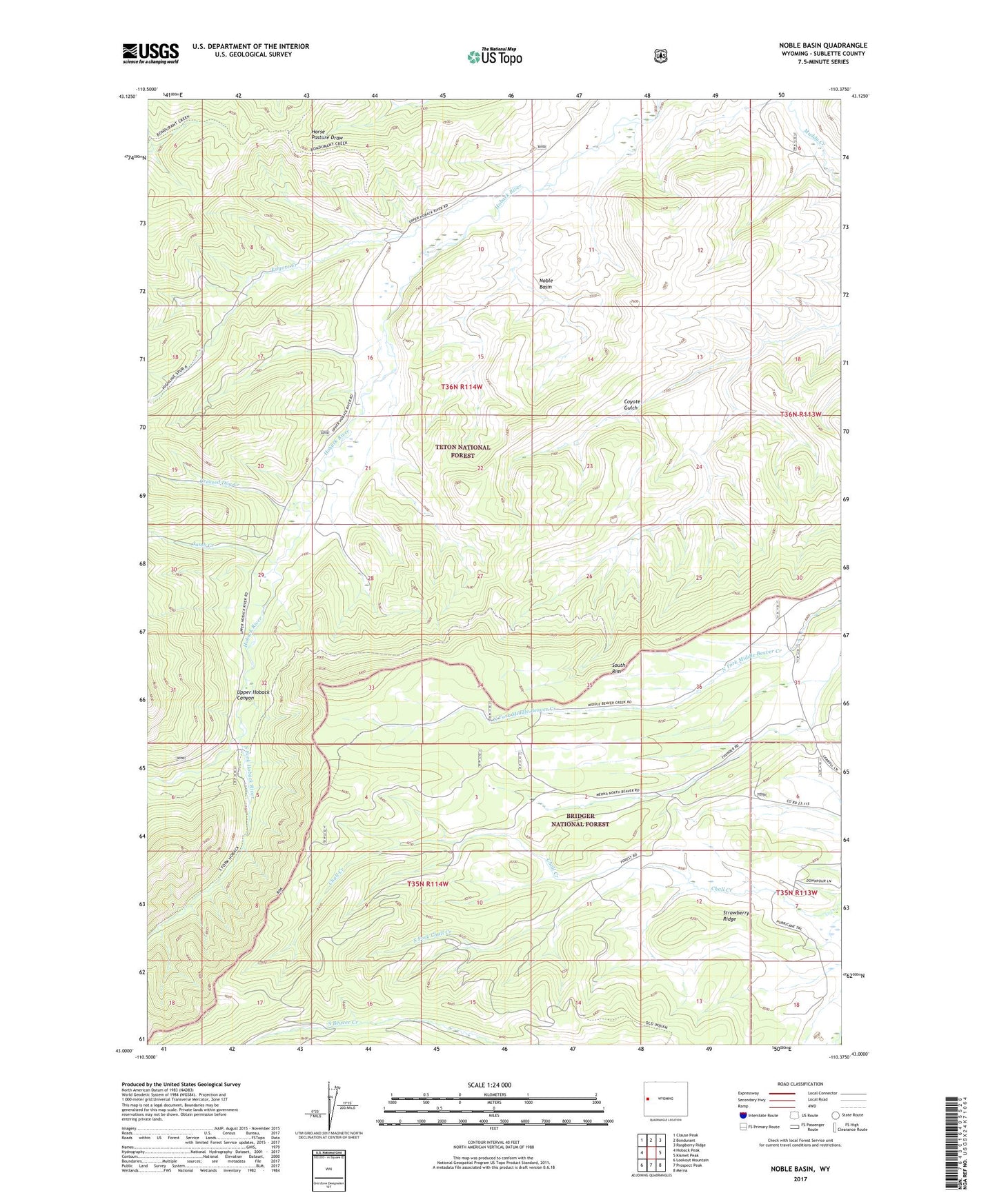
Noble Basin Wyoming US Topo Map
Couldn't load pickup availability
Also explore the Noble Basin Forest Service Topo of this same quad for updated USFS data
2021 topographic map quadrangle Noble Basin in the state of Wyoming. Scale: 1:24000. Based on the newly updated USGS 7.5' US Topo map series, this map is in the following counties: Sublette. The map contains contour data, water features, and other items you are used to seeing on USGS maps, but also has updated roads and other features. This is the next generation of topographic maps. Printed on high-quality waterproof paper with UV fade-resistant inks.
Quads adjacent to this one:
West: Hoback Peak
Northwest: Clause Peak
North: Bondurant
Northeast: Raspberry Ridge
East: Kismet Peak
Southeast: Merna
South: Prospect Peak
Southwest: Lookout Mountain
This map covers the same area as the classic USGS quad with code o43110a4.
Contains the following named places: Creased Dog Creek, Dead Shot Ranch, Jamb Creek, Kilgore Creek, Noble Basin, South Fork Chall Creek, South Fork Hoback River, Strawberry Ridge, Upper Hoback Canyon