MyTopo
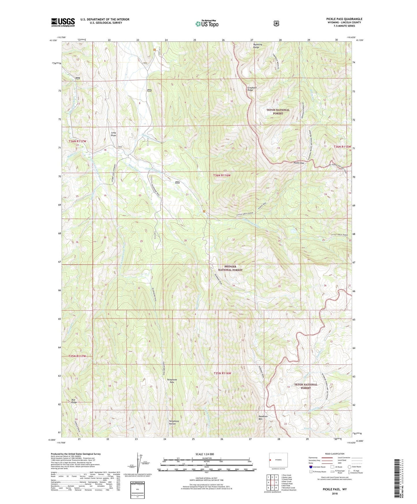
Pickle Pass Wyoming US Topo Map
Couldn't load pickup availability
Also explore the Pickle Pass Forest Service Topo of this same quad for updated USFS data
2021 topographic map quadrangle Pickle Pass in the state of Wyoming. Scale: 1:24000. Based on the newly updated USGS 7.5' US Topo map series, this map is in the following counties: Lincoln. The map contains contour data, water features, and other items you are used to seeing on USGS maps, but also has updated roads and other features. This is the next generation of topographic maps. Printed on high-quality waterproof paper with UV fade-resistant inks.
Quads adjacent to this one:
West: Deer Creek
Northwest: Pine Creek
North: Bailey Lake
Northeast: Clause Peak
East: Hoback Peak
Southeast: Lookout Mountain
South: Blind Bull Creek
Southwest: Man Peak
This map covers the same area as the classic USGS quad with code o43110a6.
Contains the following named places: Alpine Mine, Blind Trail Creek, Deadman Mountain, Grayback Ridge, Long Draw, McCain Guard Station, Middle Creek, Middle Ridge, Pickle Pass, South Fork Little Greys River, Steer Creek, Stewart Creek, Telephone Pass, ZIP Code: 83128