MyTopo
Pinedale Wyoming US Topo Map
Couldn't load pickup availability
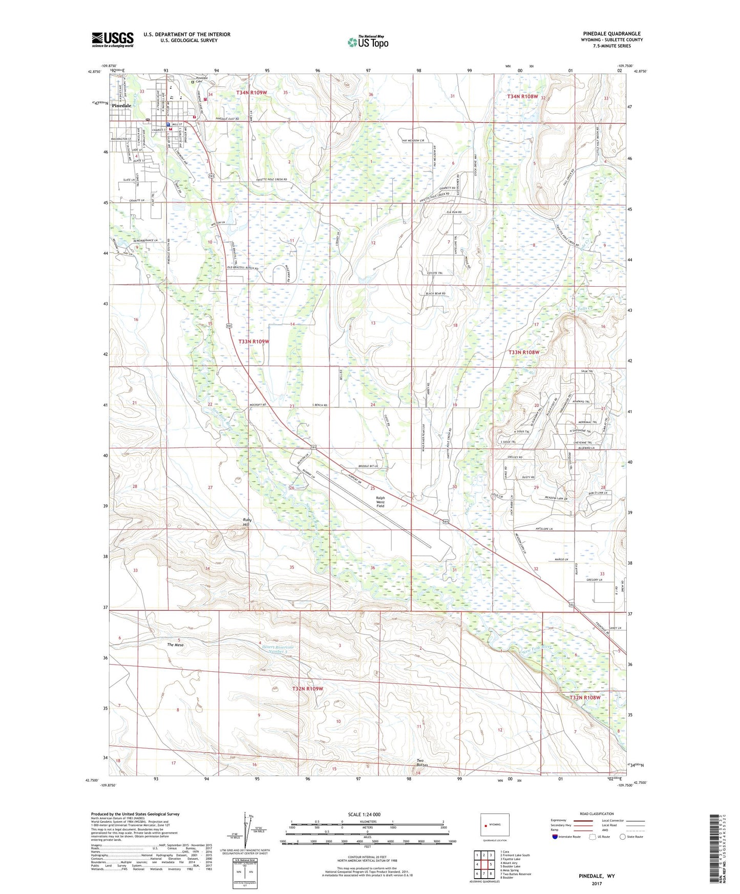
2021 topographic map quadrangle Pinedale in the state of Wyoming. Scale: 1:24000. Based on the newly updated USGS 7.5' US Topo map series, this map is in the following counties: Sublette. The map contains contour data, water features, and other items you are used to seeing on USGS maps, but also has updated roads and other features. This is the next generation of topographic maps. Printed on high-quality waterproof paper with UV fade-resistant inks.
Quads adjacent to this one:
West: Mount Airy
Northwest: Cora
North: Fremont Lake South
Northeast: Fayette Lake
East: Boulder Lake
Southeast: Boulder
South: Two Buttes Reservoir
Southwest: Mesa Spring
This map covers the same area as the classic USGS quad with code o42109g7.
Contains the following named places: Bridger - Teton National Forest Pinedale Ranger District Fire Engine Crew, Desert Reservoir Number 3, Falls Creek, Lee Ditch, Mesa Well Number 1, Mount Airy Well, Pine Creek, Pinedale, Pinedale Cemetery, Pinedale High School, Pinedale Middle School, Pinedale Post Office, Pinedale School, Pinedale Volunteer Fire Department, Pole Creek, Ralph Wenz Field, Retirement Center of Sublette County, Rocky Mountain Ambtac, Ruby Hill, Sill Ditch, Sublett County Sheriff's Office, Sublette County Emergency Medical Services - Pinedale, Town of Pinedale, Two Buttes