MyTopo
Cretaceous Mountain Wyoming US Topo Map
Couldn't load pickup availability
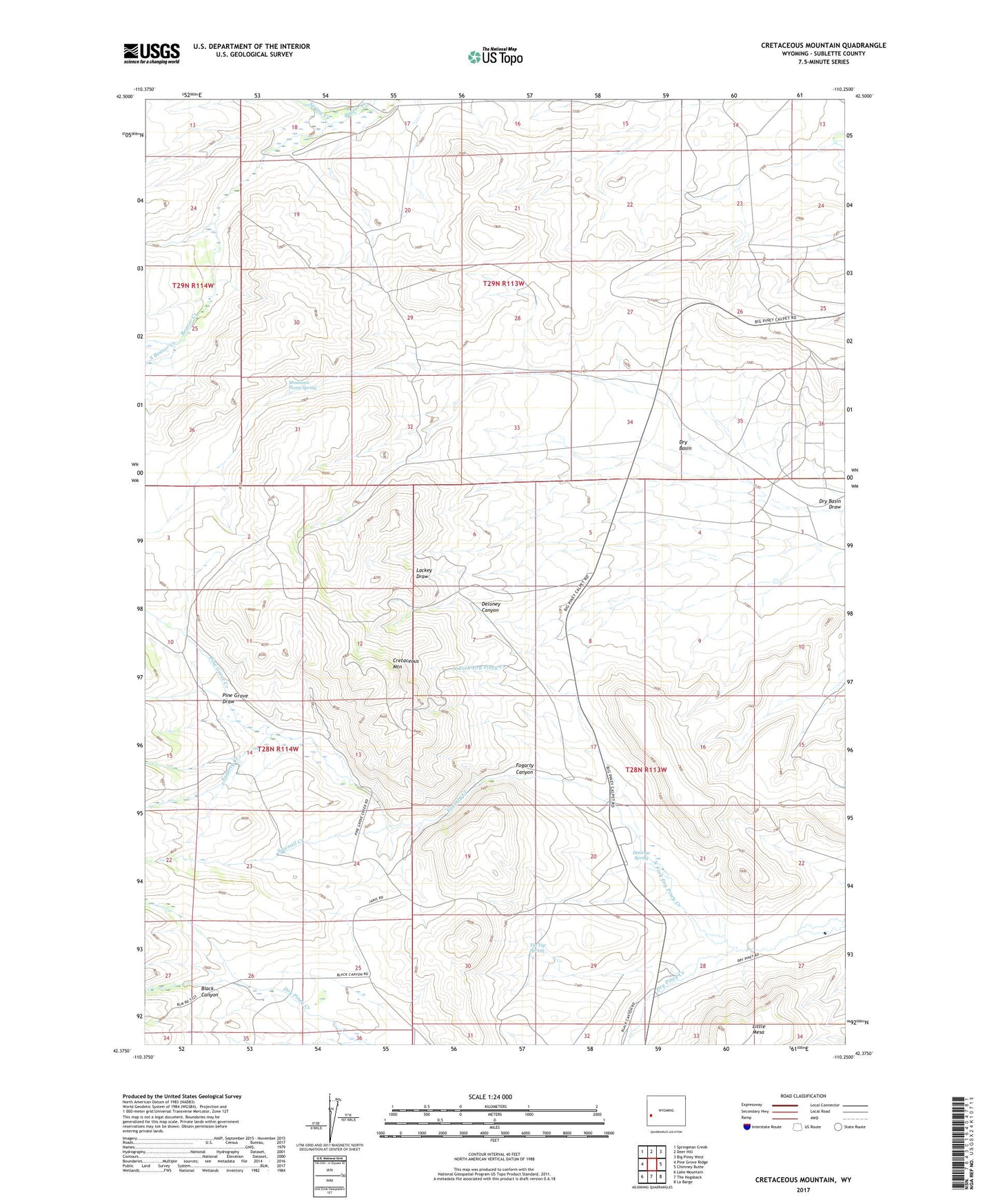
2021 topographic map quadrangle Cretaceous Mountain in the state of Wyoming. Scale: 1:24000. Based on the newly updated USGS 7.5' US Topo map series, this map is in the following counties: Sublette. The map contains contour data, water features, and other items you are used to seeing on USGS maps, but also has updated roads and other features. This is the next generation of topographic maps. Printed on high-quality waterproof paper with UV fade-resistant inks.
Quads adjacent to this one:
West: Pine Grove Ridge
Northwest: Springman Creek
North: Deer Hill
Northeast: Big Piney West
East: Chimney Butte
Southeast: La Barge
South: The Hogsback
Southwest: Lake Mountain
Contains the following named places: Black Canyon, Black Canyon Creek, Cretaceous Mountain, DeGraw Spring, Deloney Canyon, Dry Basin, Dry Basin Well, Fogarty Canyon, Fogarty Creek, Griggs Prospect, Mountain Home Ranch, Mountain Home Spring, North Fork Dry Piney Creek, Pine Grove Creek, Pine Grove Draw, Sawmill Creek, South Beaver Creek, Tip Top Spring