MyTopo
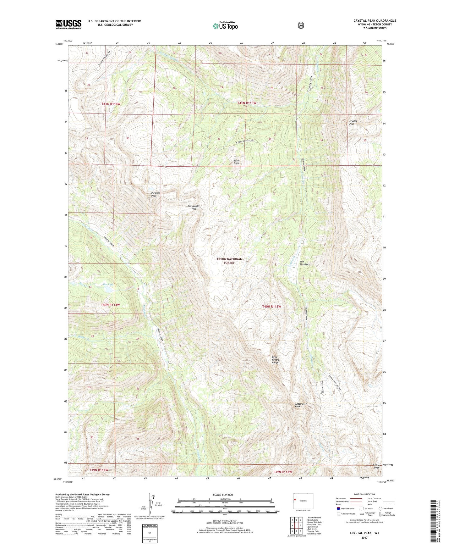
Crystal Peak Wyoming US Topo Map
Couldn't load pickup availability
Also explore the Crystal Peak Forest Service Topo of this same quad for updated USFS data
2021 topographic map quadrangle Crystal Peak in the state of Wyoming. Scale: 1:24000. Based on the newly updated USGS 7.5' US Topo map series, this map is in the following counties: Teton. The map contains contour data, water features, and other items you are used to seeing on USGS maps, but also has updated roads and other features. This is the next generation of topographic maps. Printed on high-quality waterproof paper with UV fade-resistant inks.
Quads adjacent to this one:
West: Turquoise Lake
Northwest: Blue Miner Lake
North: Grizzly Lake
Northeast: Upper Slide Lake
East: Darwin Peak
Southeast: Doubletop Peak
South: Granite Falls
Southwest: Bull Creek
This map covers the same area as the classic USGS quad with code o43110d4.
Contains the following named places: Antoinette Peak, Box Creek, Box Lake, Bunker Creek, Burnt Point, Corner Peak, Crystal Peak, Gros Ventre Wilderness, Packsaddle Pass, Pyramid Peak, The Meadows, West Fork Crystal Creek