MyTopo
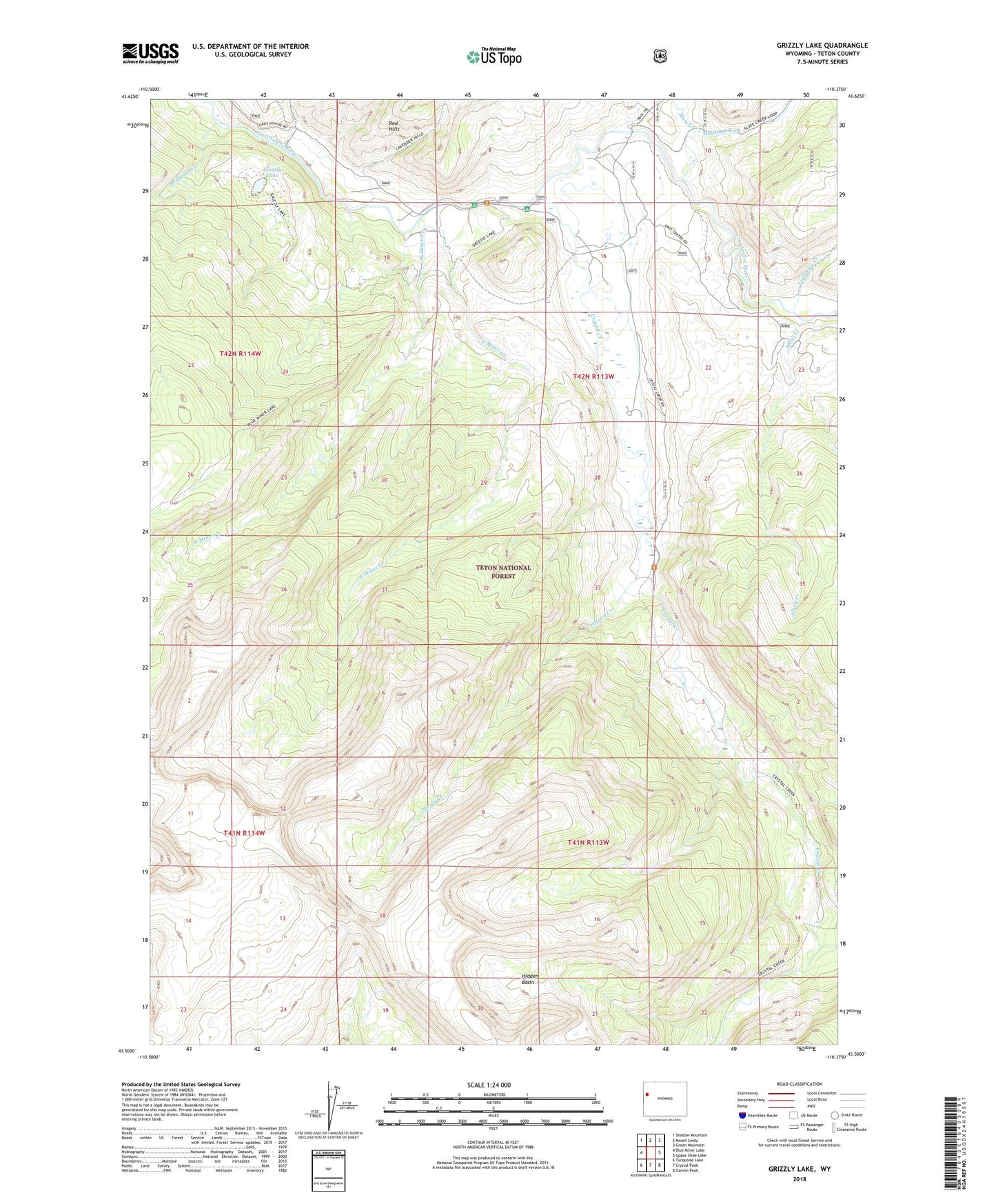
Grizzly Lake Wyoming US Topo Map
Couldn't load pickup availability
Also explore the Grizzly Lake Forest Service Topo of this same quad for updated USFS data
2021 topographic map quadrangle Grizzly Lake in the state of Wyoming. Scale: 1:24000. Based on the newly updated USGS 7.5' US Topo map series, this map is in the following counties: Teton. The map contains contour data, water features, and other items you are used to seeing on USGS maps, but also has updated roads and other features. This is the next generation of topographic maps. Printed on high-quality waterproof paper with UV fade-resistant inks.
Quads adjacent to this one:
West: Blue Miner Lake
Northwest: Shadow Mountain
North: Mount Leidy
Northeast: Green Mountain
East: Upper Slide Lake
Southeast: Darwin Peak
South: Crystal Peak
Southwest: Turquoise Lake
This map covers the same area as the classic USGS quad with code o43110e4.
Contains the following named places: Alkali Creek, Crystal Creek, Crystal Creek Campground, East Miner Creek, Grizzly Lake, Haystack Fork, Hidden Basin, Jagg Creek, Lightning Creek, Red Hills Campground, Red Rock Ranch, Redmond Creek, Shorty Creek, Slate Creek, West Miner Creek, ZIP Code: 83011