MyTopo
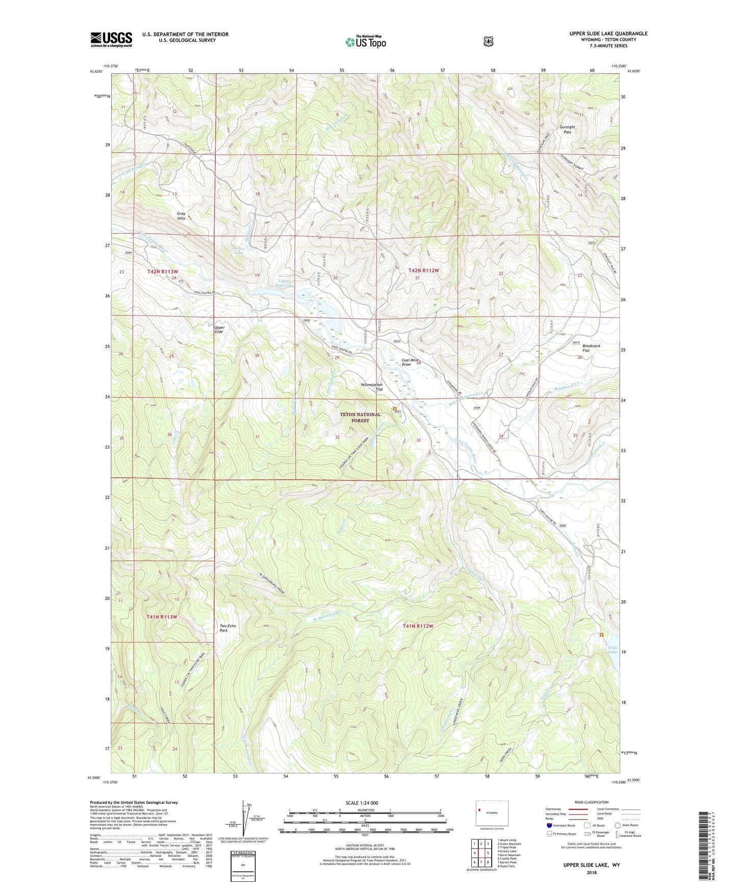
Upper Slide Lake Wyoming US Topo Map
Couldn't load pickup availability
Also explore the Upper Slide Lake Forest Service Topo of this same quad for updated USFS data
2021 topographic map quadrangle Upper Slide Lake in the state of Wyoming. Scale: 1:24000. Based on the newly updated USGS 7.5' US Topo map series, this map is in the following counties: Teton. The map contains contour data, water features, and other items you are used to seeing on USGS maps, but also has updated roads and other features. This is the next generation of topographic maps. Printed on high-quality waterproof paper with UV fade-resistant inks.
Quads adjacent to this one:
West: Grizzly Lake
Northwest: Mount Leidy
North: Green Mountain
Northeast: Tripod Peak
East: Burnt Mountain
Southeast: Ouzel Falls
South: Darwin Peak
Southwest: Crystal Peak
This map covers the same area as the classic USGS quad with code o43110e3.
Contains the following named places: Breakneck Creek, Breakneck Flat, Burnt Creek, Coal Mine Draw, Cottonwood Creek, Dallas Creek, Dallas Lake, Devils Dip Creek, Dry Cottonwood Creek, Dry Dallas Creek, Goosewing Creek, Goosewing Guard Station, Gray Hills, Gunsight Pass, Iter Gross Ventre Mine, Lake Creek, Soda Creek, Soda Lake, Tepee Creek, Two Echo Park, Upper Slide, Upper Slide Lake, West Goosewing Creek, Yellowjacket Creek, Yellowjacket Flat