MyTopo
Horse Creek Wyoming US Topo Map
Couldn't load pickup availability
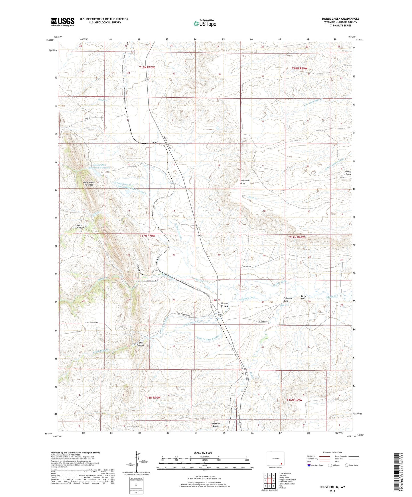
2021 topographic map quadrangle Horse Creek in the state of Wyoming. Scale: 1:24000. Based on the newly updated USGS 7.5' US Topo map series, this map is in the following counties: Laramie. The map contains contour data, water features, and other items you are used to seeing on USGS maps, but also has updated roads and other features. This is the next generation of topographic maps. Printed on high-quality waterproof paper with UV fade-resistant inks.
Quads adjacent to this one:
West: Ragged Top Mountain
Northwest: Goat Mountain
North: Farthing
Northeast: Hirsig Ranch
East: Dereemer Ranch
Southeast: Federal
South: Islay
Southwest: Green Top Mountain
This map covers the same area as the classic USGS quad with code o41105d2.
Contains the following named places: Altus, Baker Canyon, Chimney Rock, Dry Creek, Eagle Hill, Elizabeth Ditch, Fisher Canyon, Horse Creek, Horse Creek Ditch Number 3, Horse Creek Hogback, Horse Creek Post Office, Horse Creek Quarries, Horse Creek Quarry, Horse Creek Siding, Ingleside School, Laramie County Fire District 2 Horse Creek Station 3, Mayer Ditch, McLaughlin Ditch Number 5, McLaughlin Ditch Number 6, McLaughlin Number 2 Dam, McLaughlin Reservoir Number 2, Mill Creek, Murke, North Fork Horse Creek, Sophia Ditch, South Fork Horse Creek, South Horse Creek Ditch, Tromley Gulch, Whitaker Ranch, Y-Cross Ranch, ZIP Code: 82061