MyTopo
Downs Mountain Wyoming US Topo Map
Couldn't load pickup availability
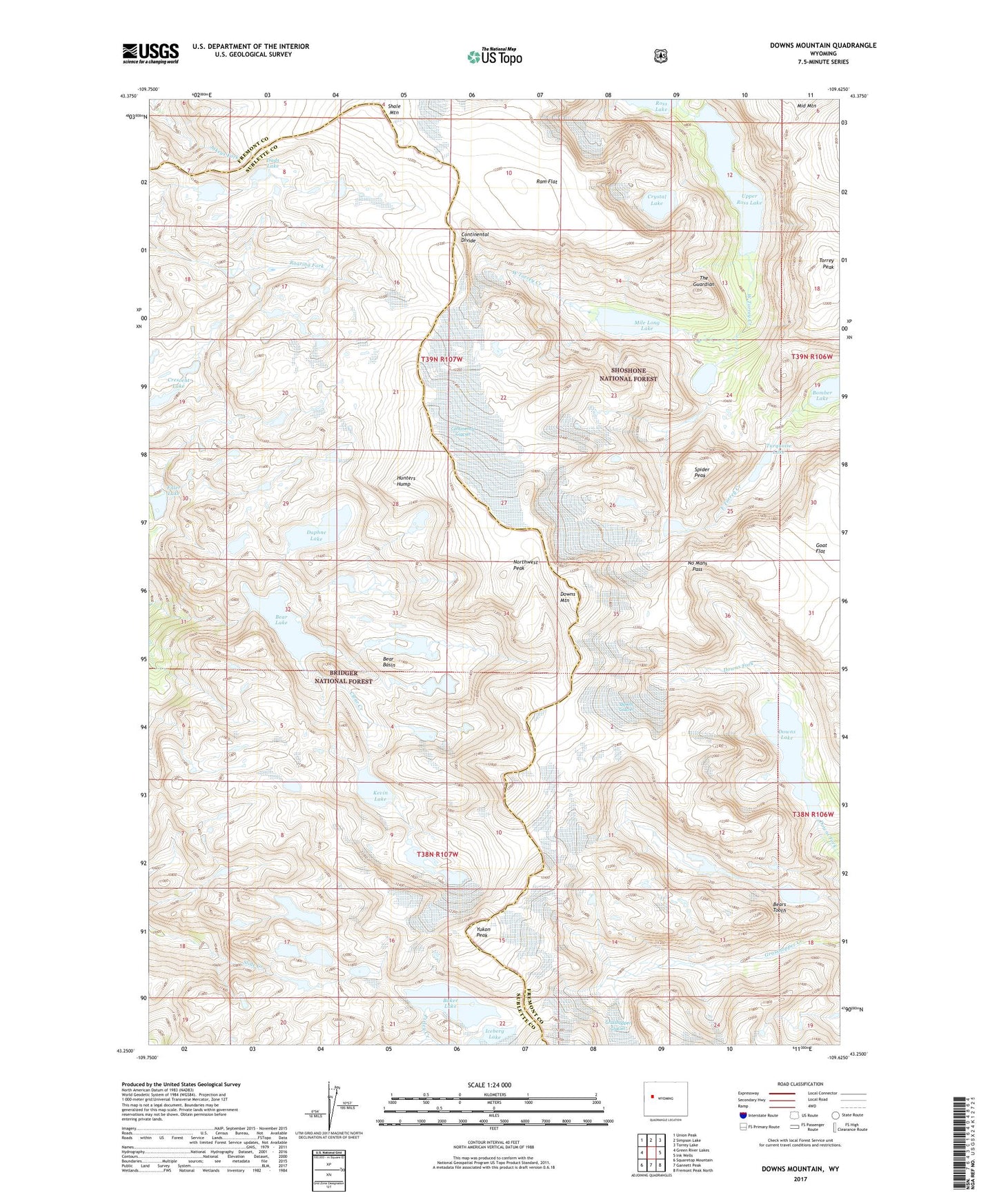
2021 topographic map quadrangle Downs Mountain in the state of Wyoming. Scale: 1:24000. Based on the newly updated USGS 7.5' US Topo map series, this map is in the following counties: Fremont, Sublette. The map contains contour data, water features, and other items you are used to seeing on USGS maps, but also has updated roads and other features. This is the next generation of topographic maps. Printed on high-quality waterproof paper with UV fade-resistant inks.
Quads adjacent to this one:
West: Green River Lakes
Northwest: Union Peak
North: Simpson Lake
Northeast: Torrey Lake
East: Ink Wells
Southeast: Fremont Peak North
South: Gannett Peak
Southwest: Squaretop Mountain
Contains the following named places: Baker Lake, Bear Basin, Bear Lake, Bears Tooth, Bomber Lake, Clear Creek Mine, Connie Glacier, Continental Glacier, Crescent Lake, Crystal Lake, Dads Lake, Daphne Lake, Downs Glacier, Downs Lake, Downs Mountain, Faler Lake, Hunters Hump, Iceberg Lake, Kevin Lake, Mile Long Lake, No Mans Pass, Northwest Peak, Ram Flat, Shale Mountain, Spider Peak, The Guardian, Torrey Peak, Turquoise Lake, Upper Ross Lake, Yukon Peak