MyTopo
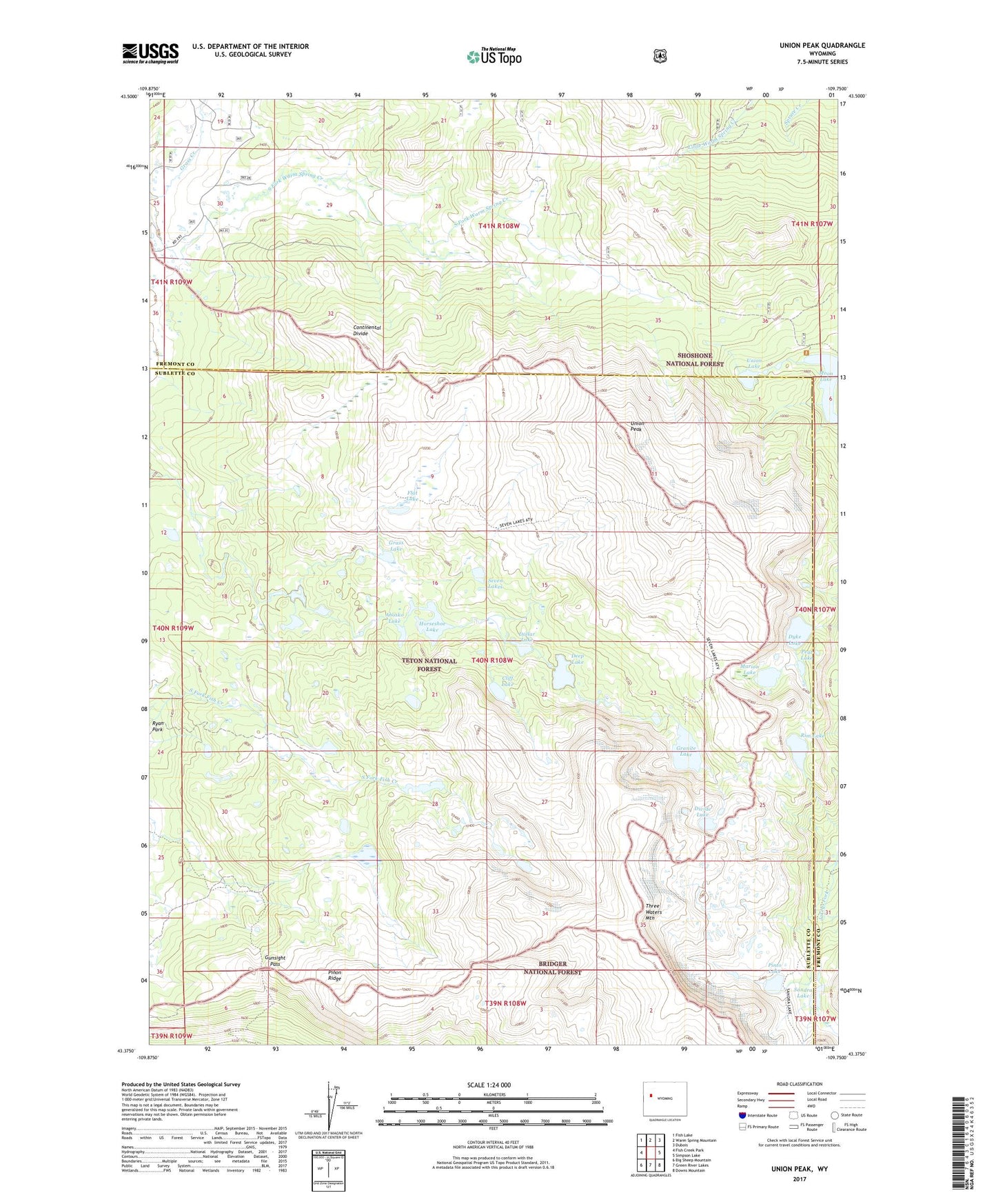
Union Peak Wyoming US Topo Map
Couldn't load pickup availability
Also explore the Union Peak Forest Service Topo of this same quad for updated USFS data
2021 topographic map quadrangle Union Peak in the state of Wyoming. Scale: 1:24000. Based on the newly updated USGS 7.5' US Topo map series, this map is in the following counties: Sublette, Fremont. The map contains contour data, water features, and other items you are used to seeing on USGS maps, but also has updated roads and other features. This is the next generation of topographic maps. Printed on high-quality waterproof paper with UV fade-resistant inks.
Quads adjacent to this one:
West: Fish Creek Park
Northwest: Fish Lake
North: Warm Spring Mountain
Northeast: Dubois
East: Simpson Lake
Southeast: Downs Mountain
South: Green River Lakes
Southwest: Big Sheep Mountain
This map covers the same area as the classic USGS quad with code o43109d7.
Contains the following named places: Abosko Lake, Cliff Lake, Deep Lake, Divide Lake, Dollar Lake, Dubois Claim Mine, Dyke Lake, Flat Lake, Granite Lake, Grass Lake, Gunsight Pass, Highline Trail, Horseshoe Lake, Long Shot Number Four Mine, Marion Lake, Moon Lake, Moon Lake Trail, Peat Lake, Pinon Ridge, Pinto Lake, Rim Lake, Sandra Lake, Seven Lakes, Three Waters Mountain, Union Lake, Union Pass Cow Camp, Union Peak, Union Peak Mine