MyTopo
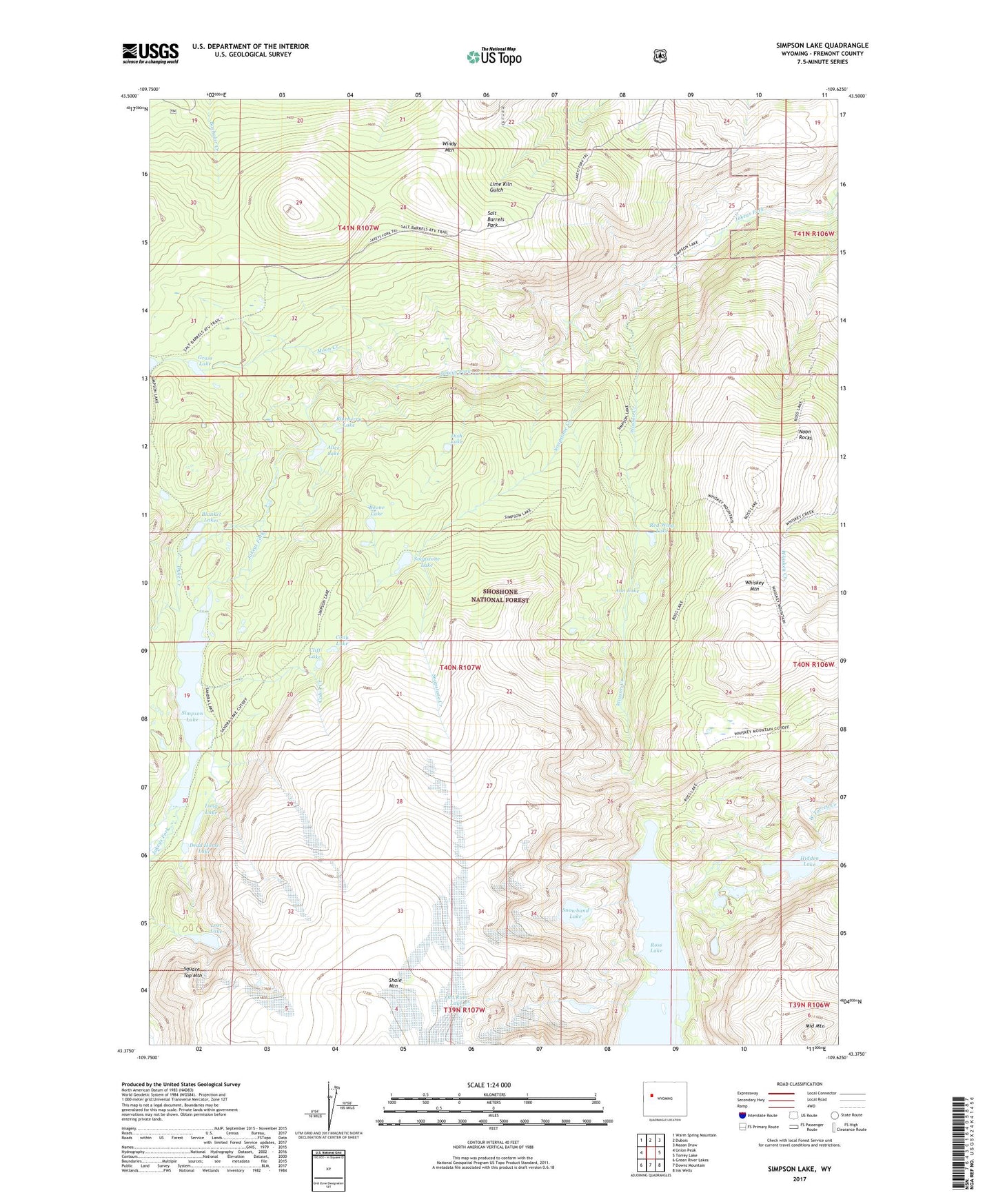
Simpson Lake Wyoming US Topo Map
Couldn't load pickup availability
Also explore the Simpson Lake Forest Service Topo of this same quad for updated USFS data
2021 topographic map quadrangle Simpson Lake in the state of Wyoming. Scale: 1:24000. Based on the newly updated USGS 7.5' US Topo map series, this map is in the following counties: Fremont. The map contains contour data, water features, and other items you are used to seeing on USGS maps, but also has updated roads and other features. This is the next generation of topographic maps. Printed on high-quality waterproof paper with UV fade-resistant inks.
Quads adjacent to this one:
West: Union Peak
Northwest: Warm Spring Mountain
North: Dubois
Northeast: Mason Draw
East: Torrey Lake
Southeast: Ink Wells
South: Downs Mountain
Southwest: Green River Lakes
This map covers the same area as the classic USGS quad with code o43109d6.
Contains the following named places: Alice Lake, Ann Lake, Big Horn Claims Mine, Big Horn Number One Mine, Blanket Lakes, Blueberry Lake, Boone Lake, C M Trail, Cabin Creek, Cliff Lake, Cony Lake, Dead Horse Lake, Dish Lake, Dyke Creek, East Fork Mine, Grass Lake, Hidden Lake, Jakeys Fork Trail, Long Lake, Lost Lake, Middle Mountain, Moon Creek, Noon Rocks, Old Ram Lake, Red Wing Lake, Ross Lake, Ross Lake Trail, Salt Barrels Park, Simpson Lake, Snowband Lake, Soapstone Creek, Soapstone Lake, Square Top Mountain, Wasson Creek, Whiskey Mountain Mining Company Number One and Six Mine, Whiskey Mountain Number Two Mine, Whiskey Mountain Trail, Whiskey Peak Mining Company Mine, Windy Mountain