MyTopo
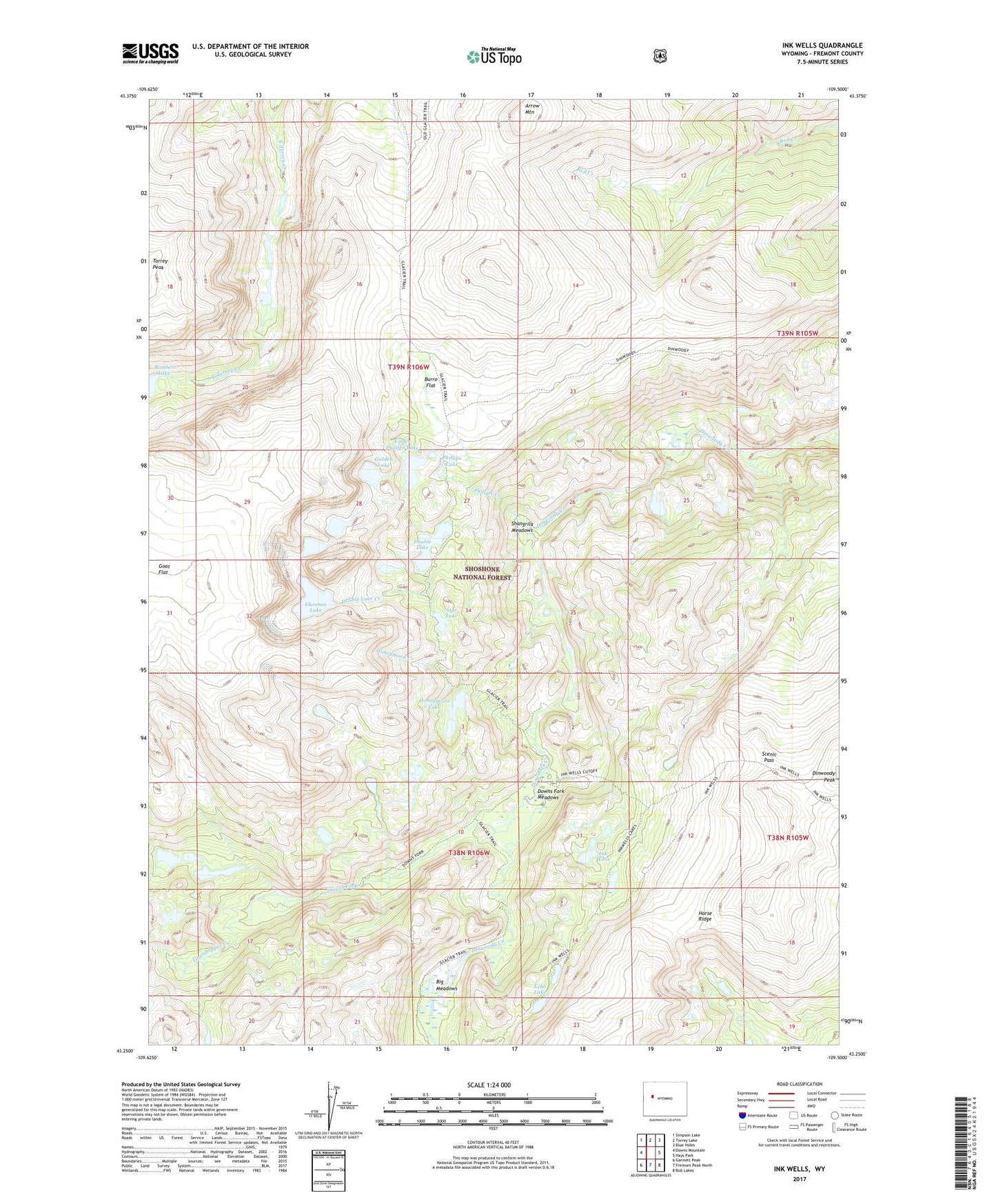
Ink Wells Wyoming US Topo Map
Couldn't load pickup availability
Also explore the Ink Wells Forest Service Topo of this same quad for updated USFS data
2021 topographic map quadrangle Ink Wells in the state of Wyoming. Scale: 1:24000. Based on the newly updated USGS 7.5' US Topo map series, this map is in the following counties: Fremont. The map contains contour data, water features, and other items you are used to seeing on USGS maps, but also has updated roads and other features. This is the next generation of topographic maps. Printed on high-quality waterproof paper with UV fade-resistant inks.
Quads adjacent to this one:
West: Downs Mountain
Northwest: Simpson Lake
North: Torrey Lake
Northeast: Blue Holes
East: Hays Park
Southeast: Bob Lakes
South: Fremont Peak North
Southwest: Gannett Peak
This map covers the same area as the classic USGS quad with code o43109c5.
Contains the following named places: Arrow Mountain, Big Meadows, Burro Flat, Dinwoody Lakes, Dinwoody Trail, Double Lake, Double Lake Creek, Downs Fork, Downs Fork Meadows, Echo Lake, Fitzpatrick Wilderness, Florence Lake, Goat Flat, Golden Lake, Grasshopper Creek, Honeymoon Creek, Honeymoon Lake, Ink Wells, Ink Wells Trail, Phillips Creek, Phillips Lake, Scenic Pass, Shangrila Meadows, Star Lake, Upper Phillips Lake, Williamson Corrals