MyTopo
Dugout Ranch Wyoming US Topo Map
Couldn't load pickup availability
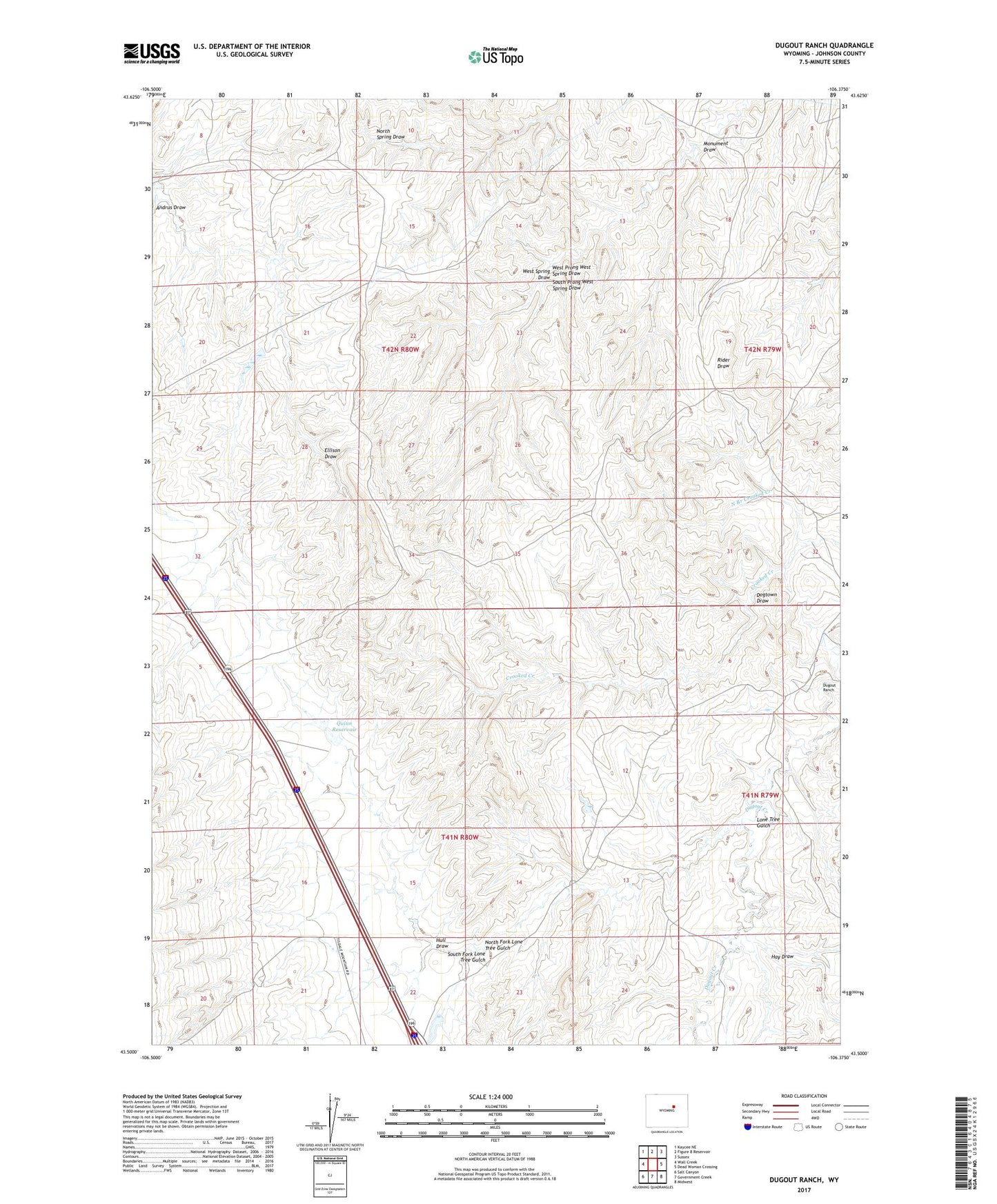
2021 topographic map quadrangle Dugout Ranch in the state of Wyoming. Scale: 1:24000. Based on the newly updated USGS 7.5' US Topo map series, this map is in the following counties: Johnson. The map contains contour data, water features, and other items you are used to seeing on USGS maps, but also has updated roads and other features. This is the next generation of topographic maps. Printed on high-quality waterproof paper with UV fade-resistant inks.
Quads adjacent to this one:
West: Wall Creek
Northwest: Kaycee NE
North: Figure 8 Reservoir
Northeast: Sussex
East: Dead Woman Crossing
Southeast: Midwest
South: Government Creek
Southwest: Salt Canyon
This map covers the same area as the classic USGS quad with code o43106e4.
Contains the following named places: Andrus Draw, Dogtown Draw, Dugout Ranch, Hay Draw, Hull Draw, Hull Ranch, Lone Tree Gulch, Monument Draw, North Branch Crooked Creek, North Fork Lone Tree Gulch, O'Conner Ranch, Quinn Dam, Quinn Reservoir, South Fork Lone Tree Gulch, South Prong West Spring Draw, West Prong West Spring Draw