MyTopo
Figure 8 Reservoir Wyoming US Topo Map
Couldn't load pickup availability
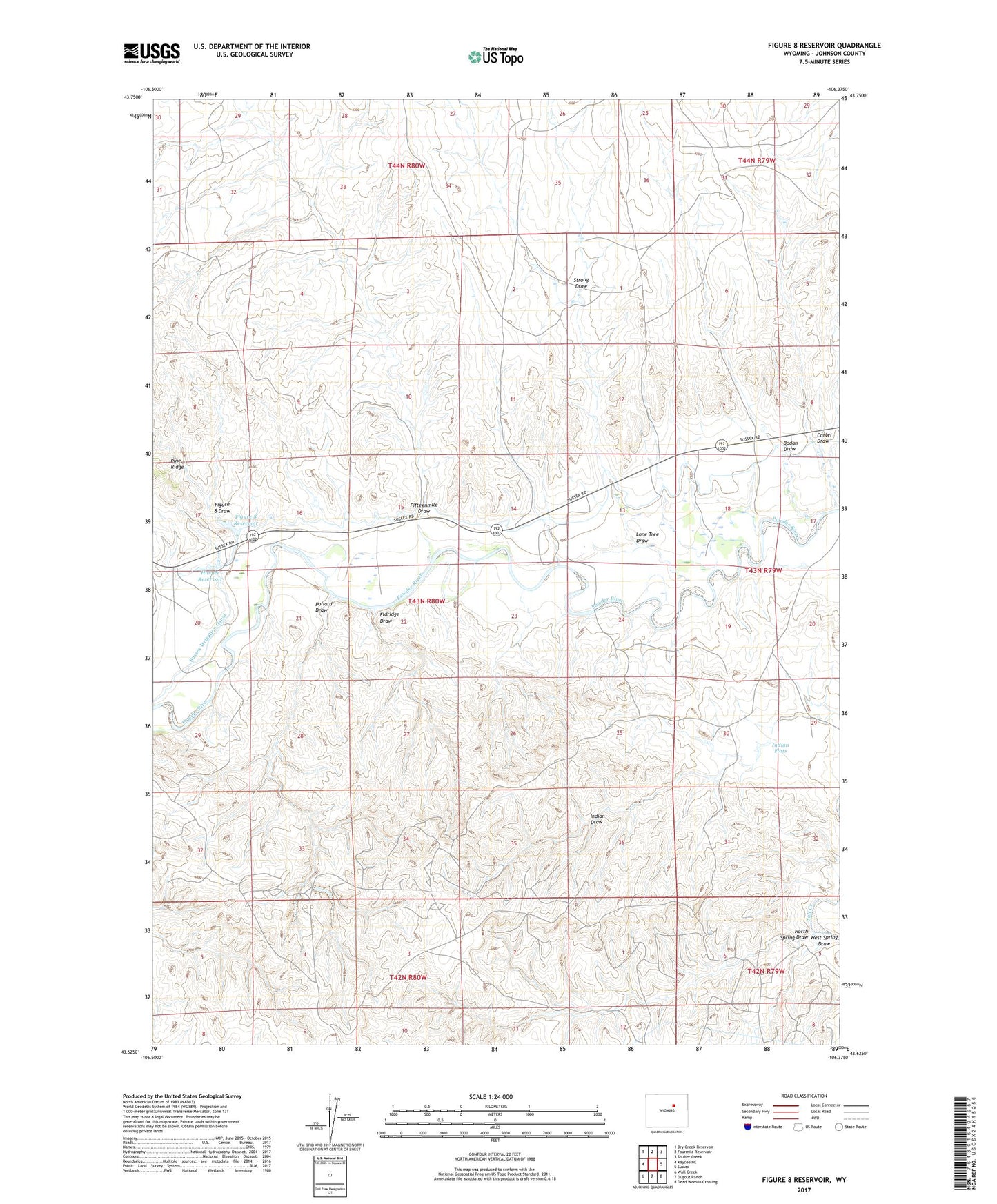
2021 topographic map quadrangle Figure 8 Reservoir in the state of Wyoming. Scale: 1:24000. Based on the newly updated USGS 7.5' US Topo map series, this map is in the following counties: Johnson. The map contains contour data, water features, and other items you are used to seeing on USGS maps, but also has updated roads and other features. This is the next generation of topographic maps. Printed on high-quality waterproof paper with UV fade-resistant inks.
Quads adjacent to this one:
West: Kaycee NE
Northwest: Dry Creek Reservoir
North: Fourmile Reservoir
Northeast: Soldier Creek
East: Sussex
Southeast: Dead Woman Crossing
South: Dugout Ranch
Southwest: Wall Creek
This map covers the same area as the classic USGS quad with code o43106f4.
Contains the following named places: Bodan Draw, Carter Draw, Chabot Ranch, Desert Queen Mine, Eldridge Draw, Fifteenmile Draw, Figure 8 Draw, Figure 8 Reservoir, Gibbs Ranch, Harper Reservoir, Indart Ranch, Indian Flats, Koch Ranch, Lone Tree Draw, Lund Ranch, Mayor Ranch, North Spring Draw, North Star Prospect, Old Kos Ranch, Pioneer Monument, Pollard Draw, Streeter Ranch, Strong Draw, Sussex Irrigation Canal, Sutton School, Taylor Ranch, West Spring Draw, West Sussex-Dugout Oil Field