MyTopo
Sussex Wyoming US Topo Map
Couldn't load pickup availability
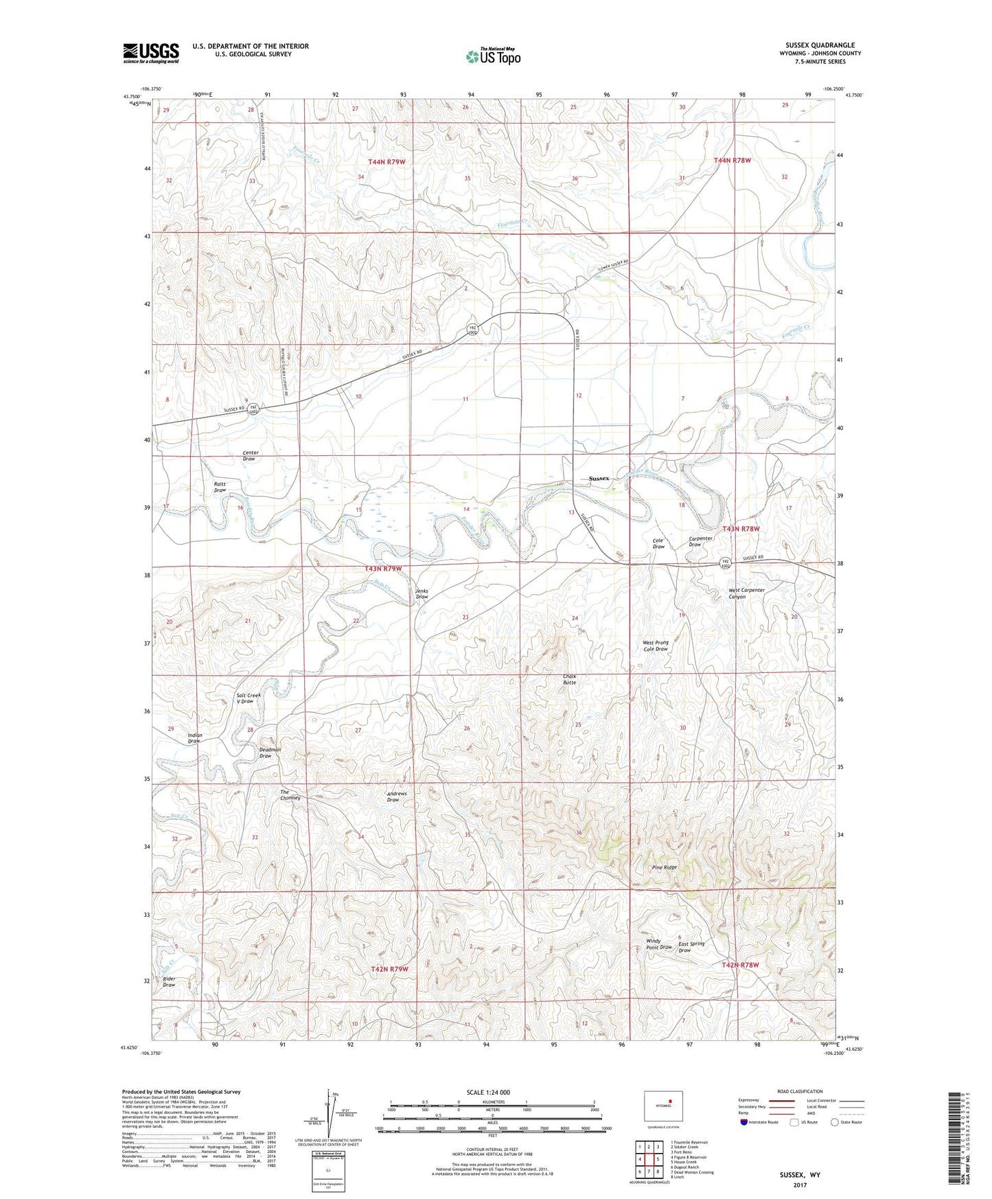
2021 topographic map quadrangle Sussex in the state of Wyoming. Scale: 1:24000. Based on the newly updated USGS 7.5' US Topo map series, this map is in the following counties: Johnson. The map contains contour data, water features, and other items you are used to seeing on USGS maps, but also has updated roads and other features. This is the next generation of topographic maps. Printed on high-quality waterproof paper with UV fade-resistant inks.
Quads adjacent to this one:
West: Figure 8 Reservoir
Northwest: Fourmile Reservoir
North: Soldier Creek
Northeast: Fort Reno
East: House Creek
Southeast: Linch
South: Dead Woman Crossing
Southwest: Dugout Ranch
This map covers the same area as the classic USGS quad with code o43106f3.
Contains the following named places: Andrews Draw, Carpenter Draw, Center Draw, Chalk Butte, Cole Draw, Deadman Draw, E Meike Ranch, E Patterson Ranch, Fourmile Creek, Garrett Ranch, H Meike Ranch, Indian Draw, Jenks Draw, Losey Ranch, Matthews Ranch, Meike Pit Number Three Mine, P Meike Ranch, Patrick Dam, Patrick Reservoir, Raitt Draw, Rider Draw, Salt Creek, Salt Creek V Draw, Skiles Pit Number One, Sussex, Sussex School, The Chimney, Turk Ranch, Vest Ranch, West Carpenter Canyon, West Prong Cole Draw, Windy Point Draw