MyTopo
Fayette Lake Wyoming US Topo Map
Couldn't load pickup availability
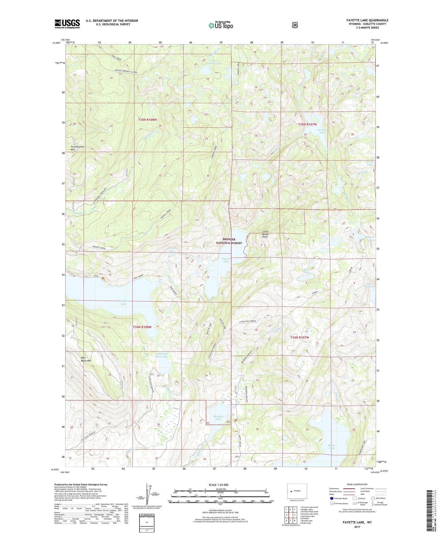
2021 topographic map quadrangle Fayette Lake in the state of Wyoming. Scale: 1:24000. Based on the newly updated USGS 7.5' US Topo map series, this map is in the following counties: Sublette. The map contains contour data, water features, and other items you are used to seeing on USGS maps, but also has updated roads and other features. This is the next generation of topographic maps. Printed on high-quality waterproof paper with UV fade-resistant inks.
Quads adjacent to this one:
West: Fremont Lake South
Northwest: Fremont Lake North
North: Bridger Lakes
Northeast: Fremont Peak South
East: Horseshoe Lake
Southeast: Scab Creek
South: Boulder Lake
Southwest: Pinedale
Contains the following named places: Baldy Creek, Belford Lake, Black Lake, Blacks Cabin, Burnt Lake, Burnt Lake Trail, Elkhart Loop Ski Trail, Fayette Cutoff Trail, Fayette Lake, Fayette Lake Trail, Fortification Mountain, Grouse Lake, Grouse Mountain Ski Trail, Half Moon Lake, Half Moon Mountain, Half Moon Trail, Junction Lake, Lake Surprise, Little Brown Point, Little Half Moon Lake, Little Half Moon Trail, Lower Sweeney Lake, Meadow Lake, North Fork Trail, Ponderosa Lodge, Spruce Creek, Surveyor Park Trail, Sweeney Creek Trail, Upper Half Moon Campground, ZIP Code: 82941