MyTopo
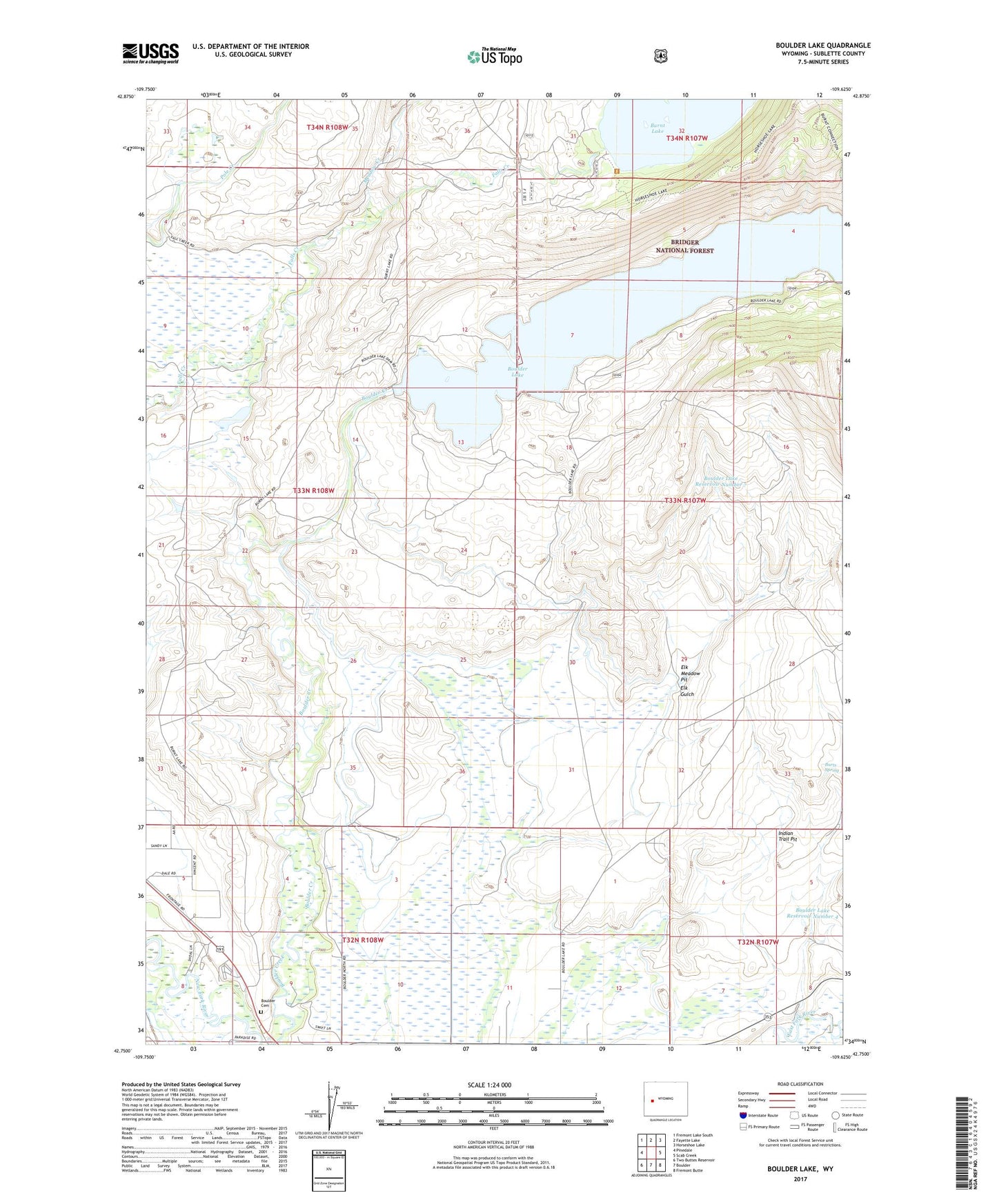
Boulder Lake Wyoming US Topo Map
Couldn't load pickup availability
Also explore the Boulder Lake Forest Service Topo of this same quad for updated USFS data
2021 topographic map quadrangle Boulder Lake in the state of Wyoming. Scale: 1:24000. Based on the newly updated USGS 7.5' US Topo map series, this map is in the following counties: Sublette. The map contains contour data, water features, and other items you are used to seeing on USGS maps, but also has updated roads and other features. This is the next generation of topographic maps. Printed on high-quality waterproof paper with UV fade-resistant inks.
Quads adjacent to this one:
West: Pinedale
Northwest: Fremont Lake South
North: Fayette Lake
Northeast: Horseshoe Lake
East: Scab Creek
Southeast: Fremont Butte
South: Boulder
Southwest: Two Buttes Reservoir
This map covers the same area as the classic USGS quad with code o42109g6.
Contains the following named places: Boulder Canal, Boulder Cemetery, Boulder Lake, Boulder Lake Dam, Boulder Lake Drift Fence, Boulder Lake Reservoir Number 4, Boulder Lake Reservoir Number 7, Burkhalter Ditch, Burts Spring, Crested Wheatgrass Windmill, Elk Gulch, Elk Meadow Pit, Fayette Ditch, Howard Routh Ditch, Indian Trail Pit, Meadow Creek, Oliver Ditch, Pole Creek Ditch Number 2, White Ditch