MyTopo
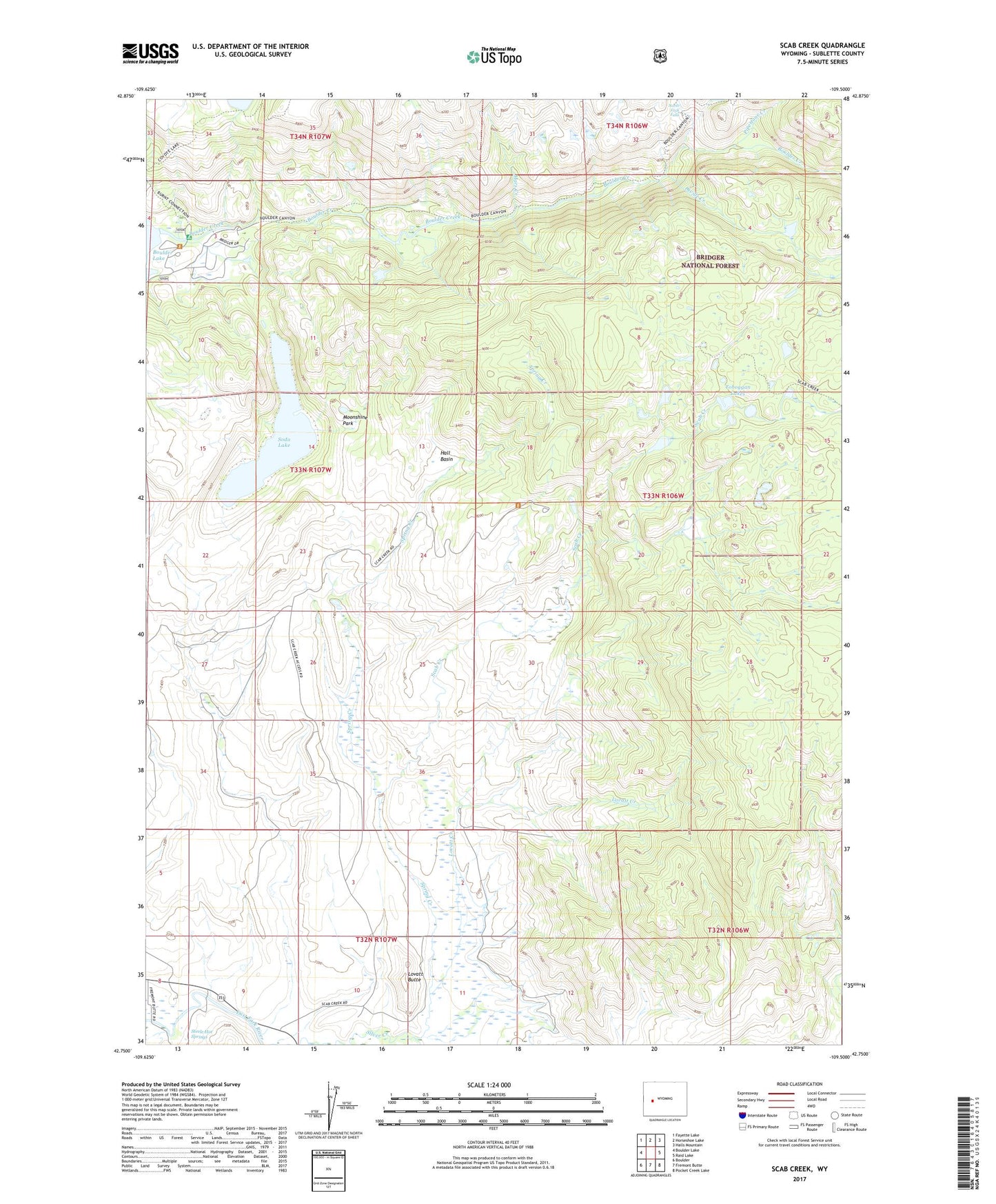
Scab Creek Wyoming US Topo Map
Couldn't load pickup availability
Also explore the Scab Creek Forest Service Topo of this same quad for updated USFS data
2021 topographic map quadrangle Scab Creek in the state of Wyoming. Scale: 1:24000. Based on the newly updated USGS 7.5' US Topo map series, this map is in the following counties: Sublette. The map contains contour data, water features, and other items you are used to seeing on USGS maps, but also has updated roads and other features. This is the next generation of topographic maps. Printed on high-quality waterproof paper with UV fade-resistant inks.
Quads adjacent to this one:
West: Boulder Lake
Northwest: Fayette Lake
North: Horseshoe Lake
Northeast: Halls Mountain
East: Raid Lake
Southeast: Pocket Creek Lake
South: Fremont Butte
Southwest: Boulder
This map covers the same area as the classic USGS quad with code o42109g5.
Contains the following named places: Boulder Campground, Boulder Canyon Trail, Boulder Lake Campground, Boulder Lake Ranch, Divide Creek, Hall Basin, Jaycox Number 1 Ditch, Lovatt Butte, Lovatt Creek, Lovatt Ditch, Macs Creek, Moonshine Park, Mountain Springs Ranch, North Fork Boulder Creek, North Fork Falls, Pipestone Creek, Scab Creek, Scab Creek Campground, Scab Lake Trail, Silver Creek Canyon, Soda Lake, Spring Creek, Steele Hot Springs, Taylor Ditch, Toboggan Lakes