MyTopo
Wheatland Wyoming US Topo Map
Couldn't load pickup availability
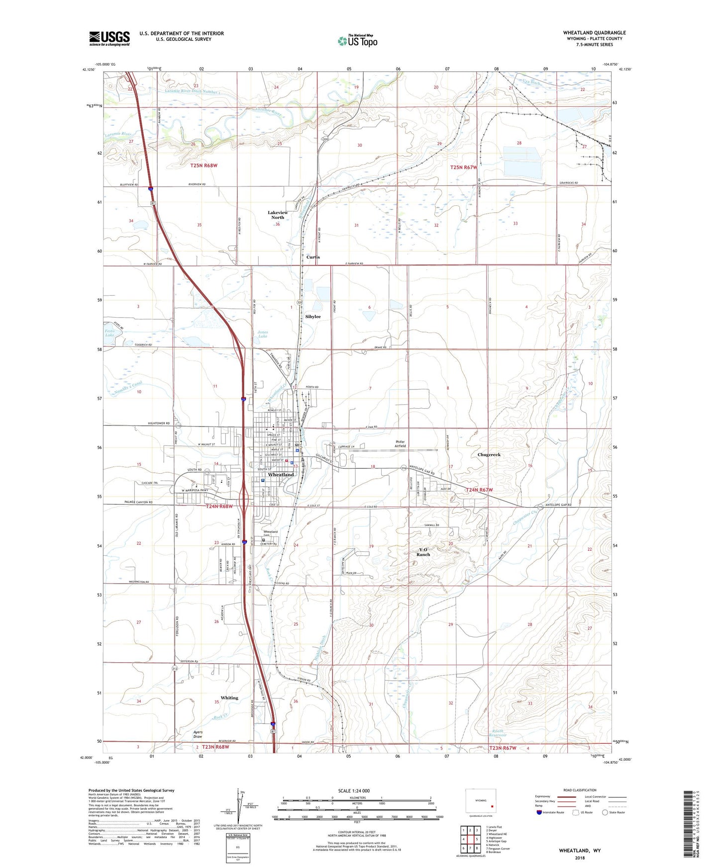
2021 topographic map quadrangle Wheatland in the state of Wyoming. Scale: 1:24000. Based on the newly updated USGS 7.5' US Topo map series, this map is in the following counties: Platte. The map contains contour data, water features, and other items you are used to seeing on USGS maps, but also has updated roads and other features. This is the next generation of topographic maps. Printed on high-quality waterproof paper with UV fade-resistant inks.
Quads adjacent to this one:
West: Hightower
Northwest: Lewis Flat
North: Dwyer
Northeast: Wheatland NE
East: Antelope Gap
Southeast: Bordeaux
South: Ferguson Corner
Southwest: Natwick
This map covers the same area as the classic USGS quad with code o42104a8.
Contains the following named places: Ayers Draw, Bard Ranch, Chugcreek, Chugcreek Census Designated Place, City Ditch, Cottonwood School, Curtis, Eastern Wyoming Ambulance, Festo Lake, Gibson, Highline Ditch, Jones Lake, KYCN-AM (Wheatland), KYCN-FM (Wheatland), Lakeview North Census Designated Place, Laramie River Ditch Number 1, Libbey School, Mbpp Raw Water Storage Dam, MBPP Storm Runoff Retention Reservoir, Meadowlark Maison Hospital, Moody Community Club, Number 2 Canal, Phifer Airfield, Phifer Ranch, Platte County Memorial Hospital, Platte County Memorial Nursing Home, Platte County Sheriff's Office, Roath Dam, Roath Reservoir, Rock Creek, Sibylee, Sibylee School, Timber Canyon Ranch School, Town of Wheatland, Uva Ditch, West School, Wheatland, Wheatland Cemetery, Wheatland High School, Wheatland Junior High School, Wheatland Police Department, Wheatland Post Office, Wheatland Volunteer Fire Department, Whiting, Whiting Census Designated Place, Y-O Ranch, Y-O Ranch Census Designated Place