MyTopo
Flat Top Hill Wyoming US Topo Map
Couldn't load pickup availability
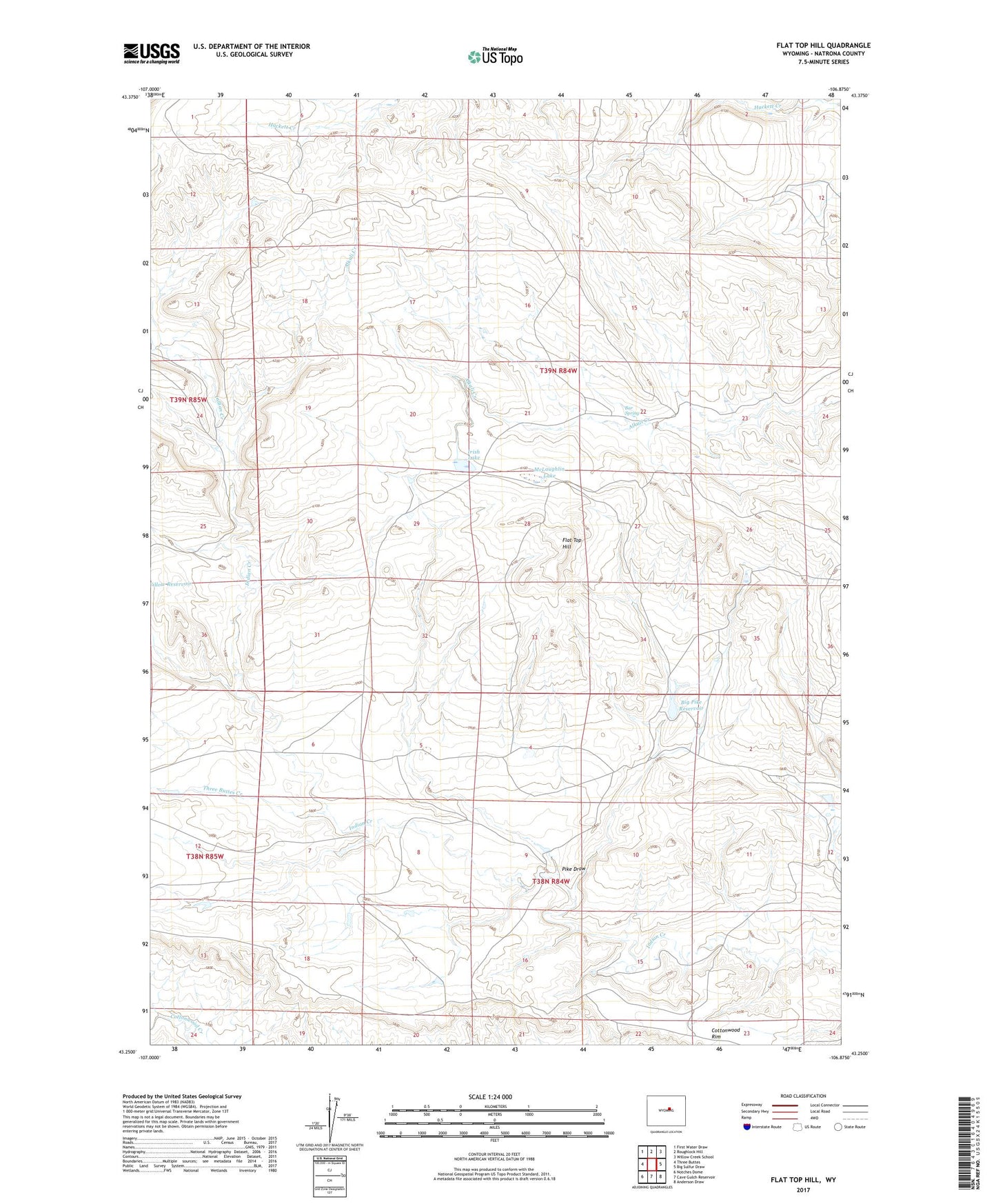
2021 topographic map quadrangle Flat Top Hill in the state of Wyoming. Scale: 1:24000. Based on the newly updated USGS 7.5' US Topo map series, this map is in the following counties: Natrona. The map contains contour data, water features, and other items you are used to seeing on USGS maps, but also has updated roads and other features. This is the next generation of topographic maps. Printed on high-quality waterproof paper with UV fade-resistant inks.
Quads adjacent to this one:
West: Three Buttes
Northwest: First Water Draw
North: Roughlock Hill
Northeast: Willow Creek School
East: Big Sulfur Draw
Southeast: Anderson Draw
South: Cave Gulch Reservoir
Southwest: Notches Dome
This map covers the same area as the classic USGS quad with code o43106c8.
Contains the following named places: Bar Spring, Big Pike Dam, Big Pike Reservoir, Cottonwood Rim, Flat Top Hill, Irish Lake, Kidd Ranch Number Five Mine, Kidd Ranch Number One Mine, Kidd Ranch Number Six Mine, Kidd Ranch Number Ten Mine, Kidd Ranch Number Twelve Mine, Kidd Ranch Number Two Mine, Lower Hackett Dam, McLaughlin Lake, Pike Draw, Three Buttes Creek, Upper Hacket Dam, Upper Hacket Reservoir