MyTopo
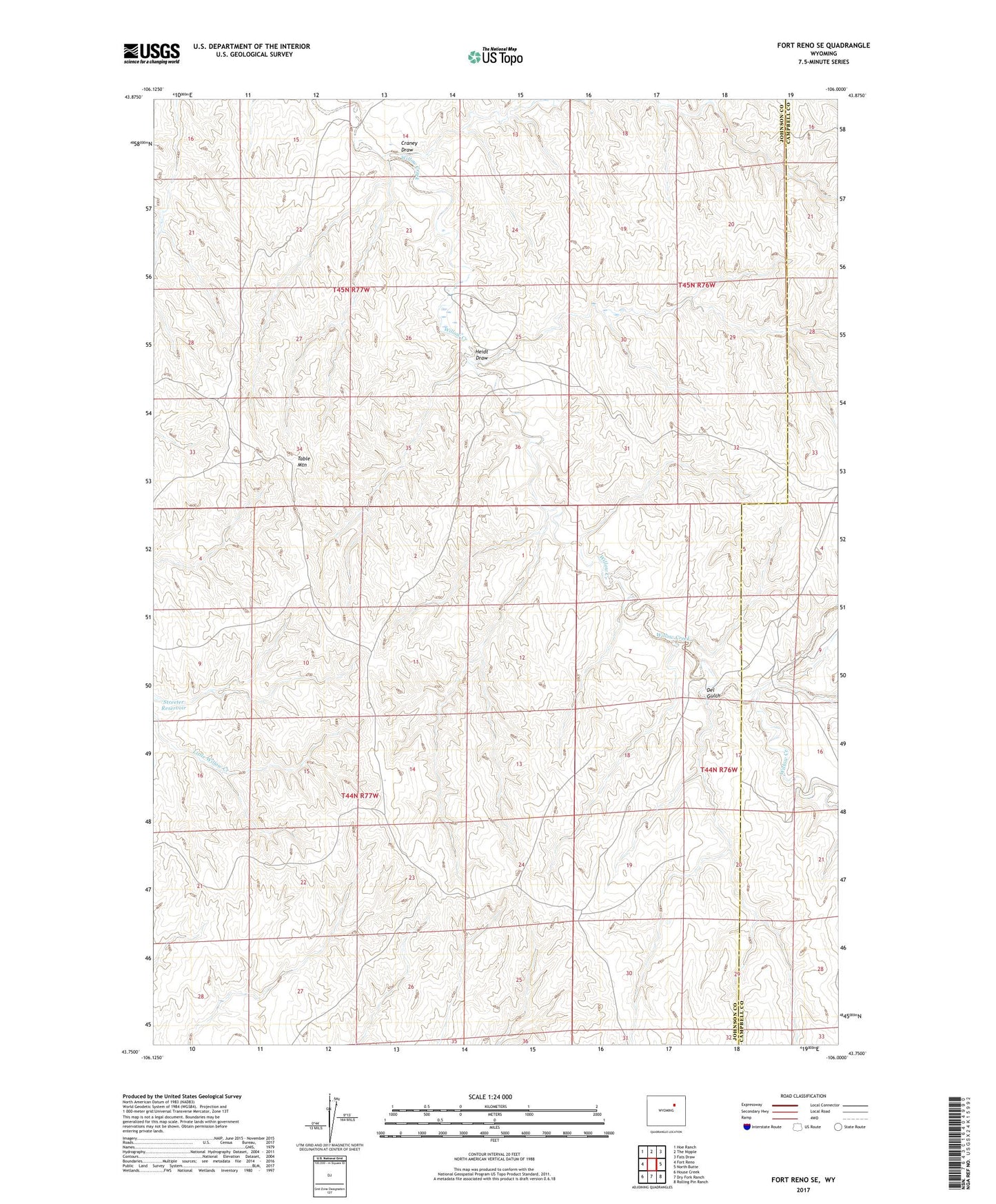
Fort Reno SE Wyoming US Topo Map
Couldn't load pickup availability
2021 topographic map quadrangle Fort Reno SE in the state of Wyoming. Scale: 1:24000. Based on the newly updated USGS 7.5' US Topo map series, this map is in the following counties: Johnson, Campbell. The map contains contour data, water features, and other items you are used to seeing on USGS maps, but also has updated roads and other features. This is the next generation of topographic maps. Printed on high-quality waterproof paper with UV fade-resistant inks.
Quads adjacent to this one:
West: Fort Reno
Northwest: Hoe Ranch
North: The Nipple
Northeast: Fats Draw
East: North Butte
Southeast: Rolling Pin Ranch
South: Dry Fork Ranch
Southwest: House Creek
This map covers the same area as the classic USGS quad with code o43106g1.
Contains the following named places: A-Number Ninety-three Mine, Channel Deposit Mine, Charlite Ore Body Mine, Christensen Lease Mine, Christensen Lease Number Two Mine, Christianson Ranch Joint Venture Mine, Craney Draw, Del Gulch, Drew Ranch, Drew Well, First Well, Frank Claims, Heidt Draw, Jack Christansen Mine, Jane One Mine, John Christian Pit, Karl Three Claim, Kerr-McGee Stan Seven and Eight Claims, Lem Three and Four Moe Three and Four Claims, Middle Well, Moe Fourteen Mine, North Prong Willow Creek, Ole Claims Mine, Opal Claims, Quincy Claims, Ray Claims, Sad Sack Six Mine, South Peak Mining Property Mine, Table Mountain