MyTopo
Fort Reno Wyoming US Topo Map
Couldn't load pickup availability
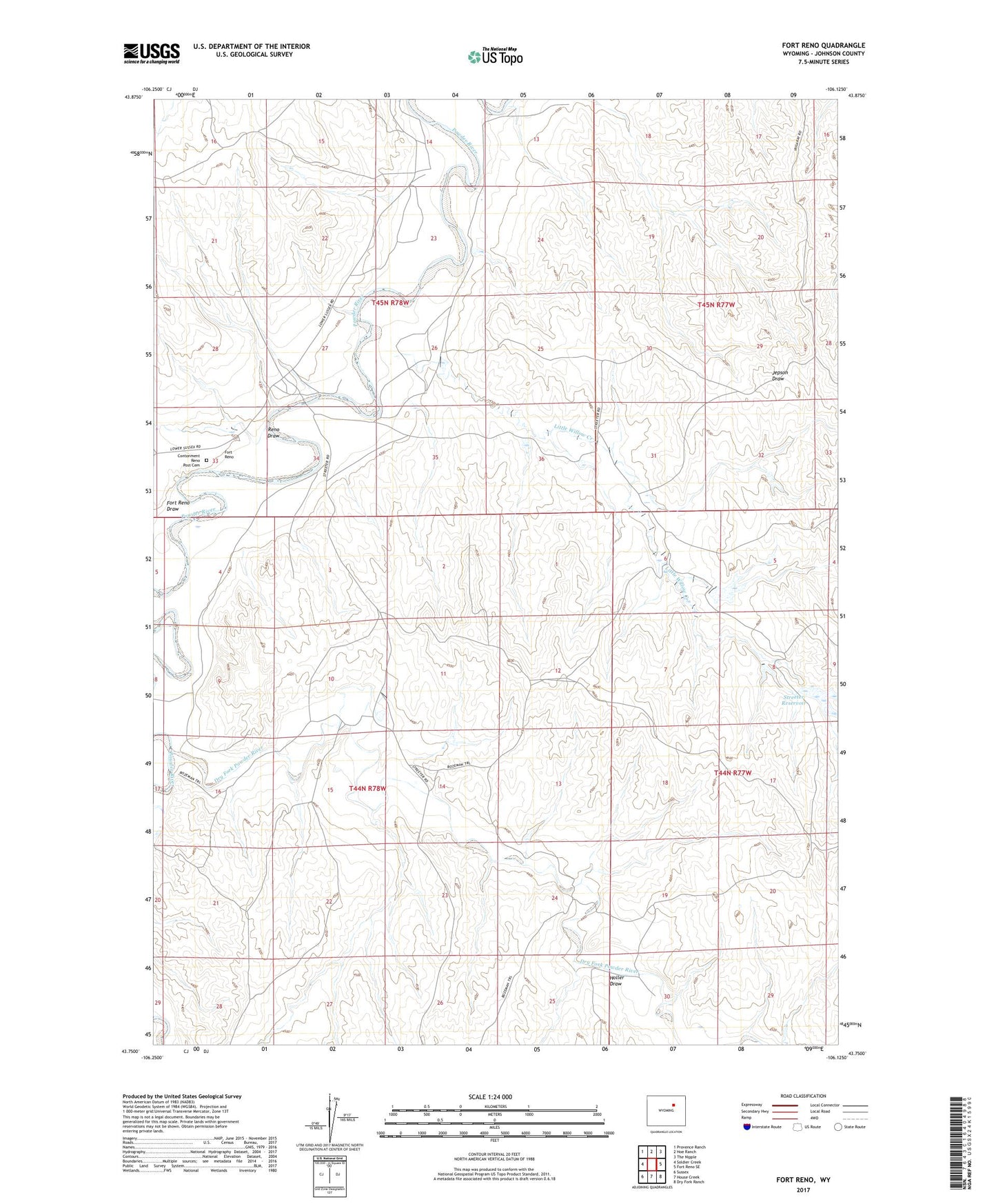
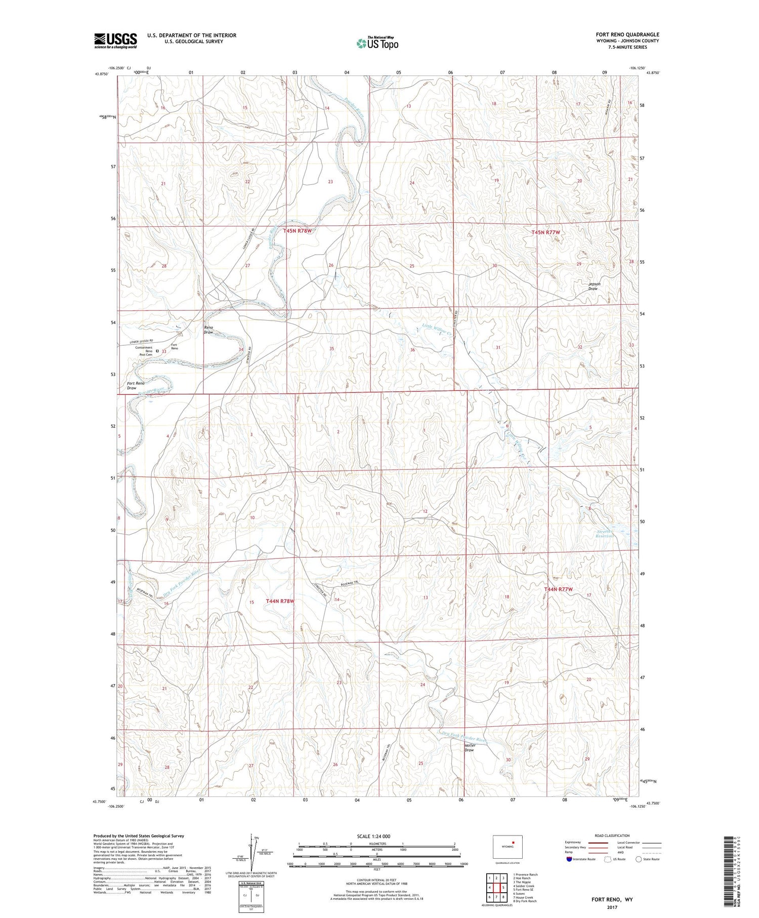
2021 topographic map quadrangle Fort Reno in the state of Wyoming. Scale: 1:24000. Based on the newly updated USGS 7.5' US Topo map series, this map is in the following counties: Johnson. The map contains contour data, water features, and other items you are used to seeing on USGS maps, but also has updated roads and other features. This is the next generation of topographic maps. Printed on high-quality waterproof paper with UV fade-resistant inks.
Quads adjacent to this one:
West: Soldier Creek
Northwest: Provence Ranch
North: Hoe Ranch
Northeast: The Nipple
East: Fort Reno SE
Southeast: Dry Fork Ranch
South: House Creek
Southwest: Sussex
Contains the following named places: Contonment Reno Post Cemetery, Davis Ranch, Dry Fork Powder River, Fort Reno, Fort Reno Draw, Garrett Cow Camp, Holler Draw, Little Willow Creek, Lucky Seven Mine, Payseno Ranch, Reculusa Ranch, Reno Draw, Robinson Ranch, Soldier Creek, Streeter Dam, Streeter Reservoir, Urruty Ranch, Z L Bar Ranch