MyTopo
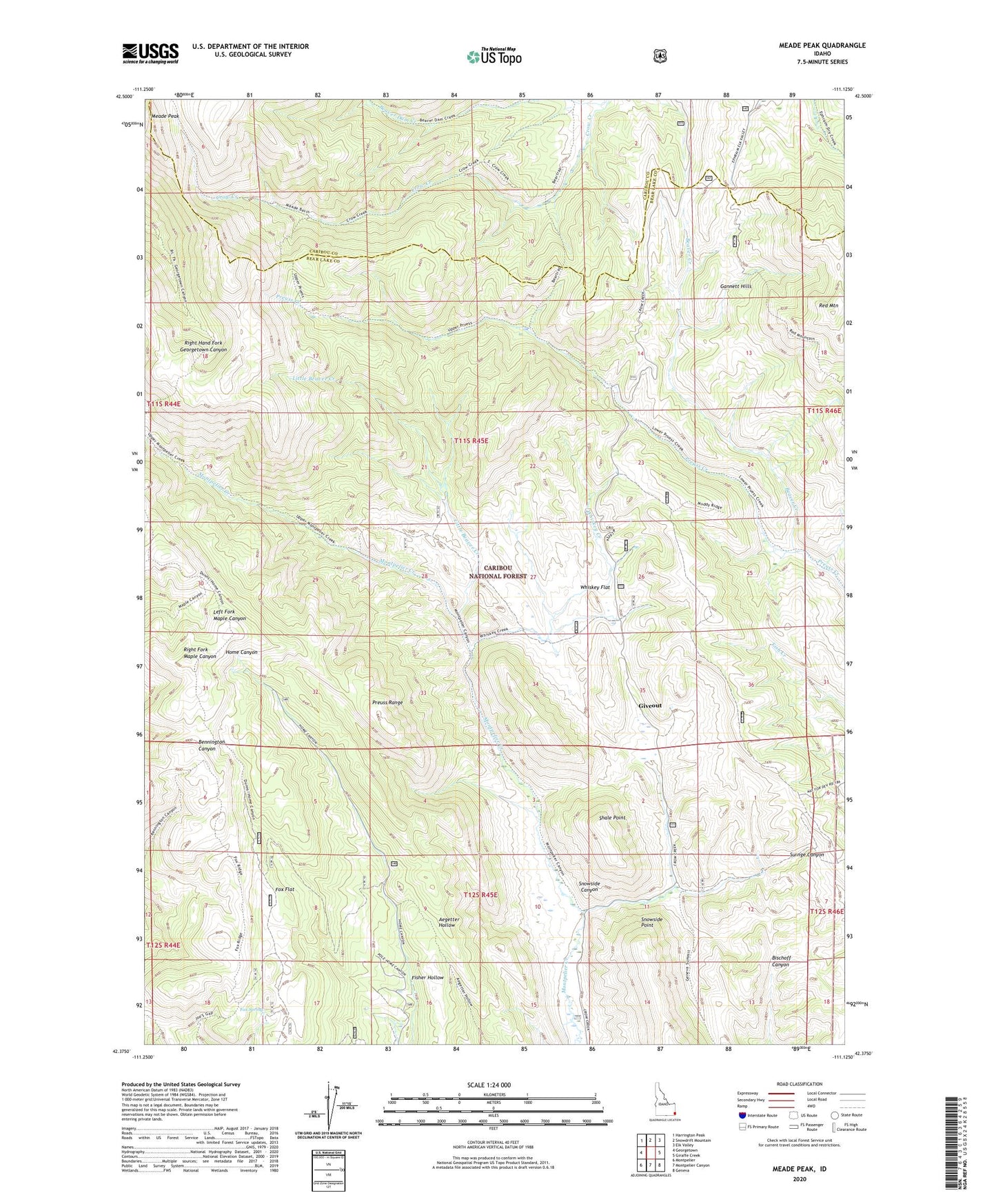
Meade Peak Idaho US Topo Map
Couldn't load pickup availability
Also explore the Meade Peak Forest Service Topo of this same quad for updated USFS data
2023 topographic map quadrangle Meade Peak in the state of Idaho. Scale: 1:24000. Based on the newly updated USGS 7.5' US Topo map series, this map is in the following counties: Bear Lake, Caribou. The map contains contour data, water features, and other items you are used to seeing on USGS maps, but also has updated roads and other features. This is the next generation of topographic maps. Printed on high-quality waterproof paper with UV fade-resistant inks.
Quads adjacent to this one:
West: Georgetown
Northwest: Harrington Peak
North: Snowdrift Mountain
Northeast: Elk Valley
East: Giraffe Creek
Southeast: Geneva
South: Montpelier Canyon
Southwest: Montpelier
This map covers the same area as the classic USGS quad with code o42111d2.
Contains the following named places: Beaver Creek, Beaver Dam Creek, Fisher Hollow, Fox Flat, Fox Spring, Giveout, Little Beaver Creek, Meade Peak, Preuss Range, Red Mountain, Shale Point, Snowside Canyon, Snowside Point, Whiskey Creek, Whiskey Flat