MyTopo
Goff Lake Wyoming US Topo Map
Couldn't load pickup availability
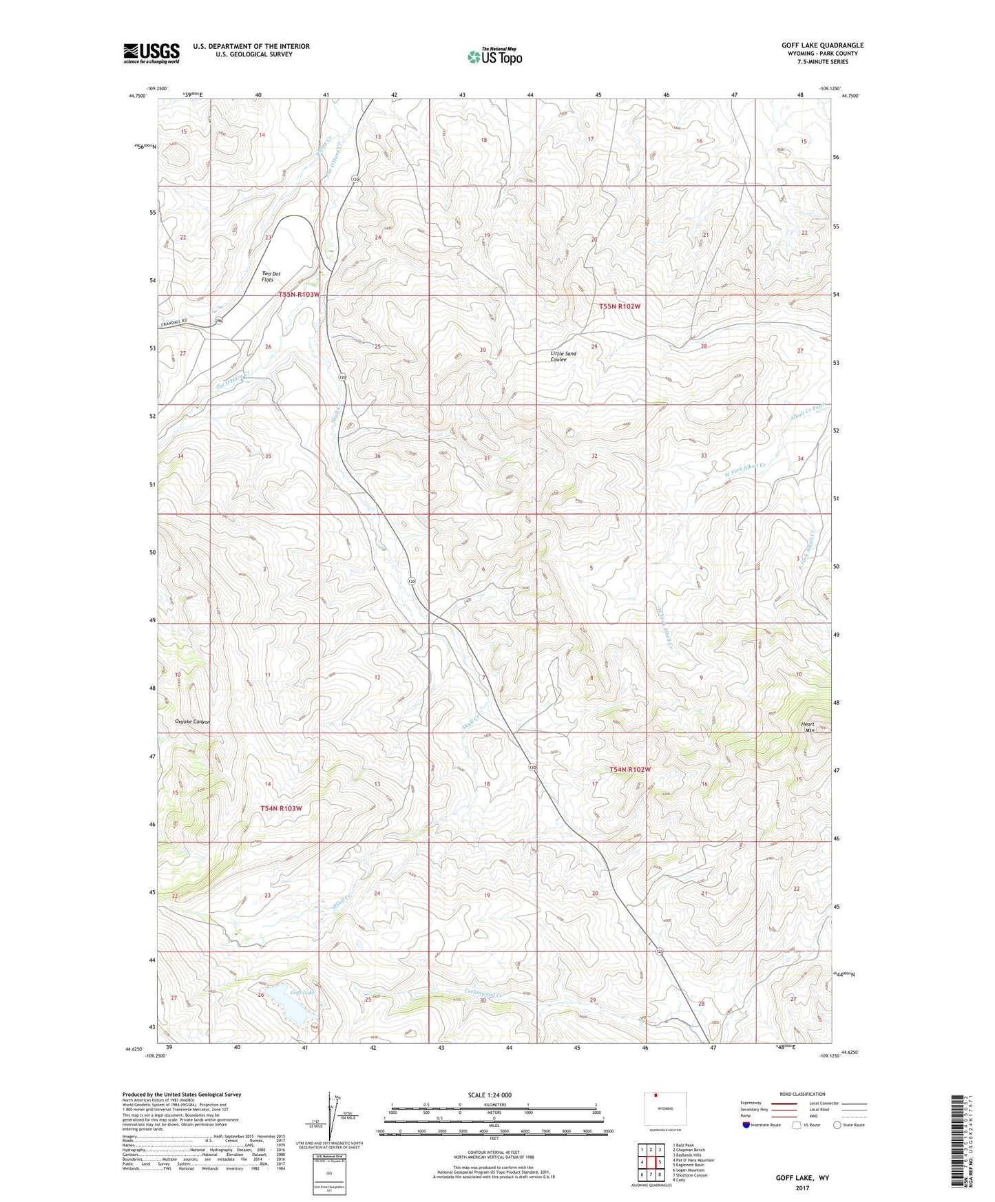
2021 topographic map quadrangle Goff Lake in the state of Wyoming. Scale: 1:24000. Based on the newly updated USGS 7.5' US Topo map series, this map is in the following counties: Park. The map contains contour data, water features, and other items you are used to seeing on USGS maps, but also has updated roads and other features. This is the next generation of topographic maps. Printed on high-quality waterproof paper with UV fade-resistant inks.
Quads adjacent to this one:
Northwest: Bald Peak
North: Chapman Bench
Northeast: Badlands Hills
East: Eaglenest Basin
Southeast: Cody
South: Shoshone Canyon
Southwest: Logan Mountain
This map covers the same area as the classic USGS quad with code o44109f2.
Contains the following named places: Allison Mine, Blaine Creek, East Fork Alkali Creek, Heart Mountain, Johnson Ranch, Lanchbury Ranch, Marlow Ranch, Oxyoke Canyon, Skull Creek, Trask Ranch, Two Dot Flats, Two Dot Ranch, West Fork Alkali Creek