MyTopo
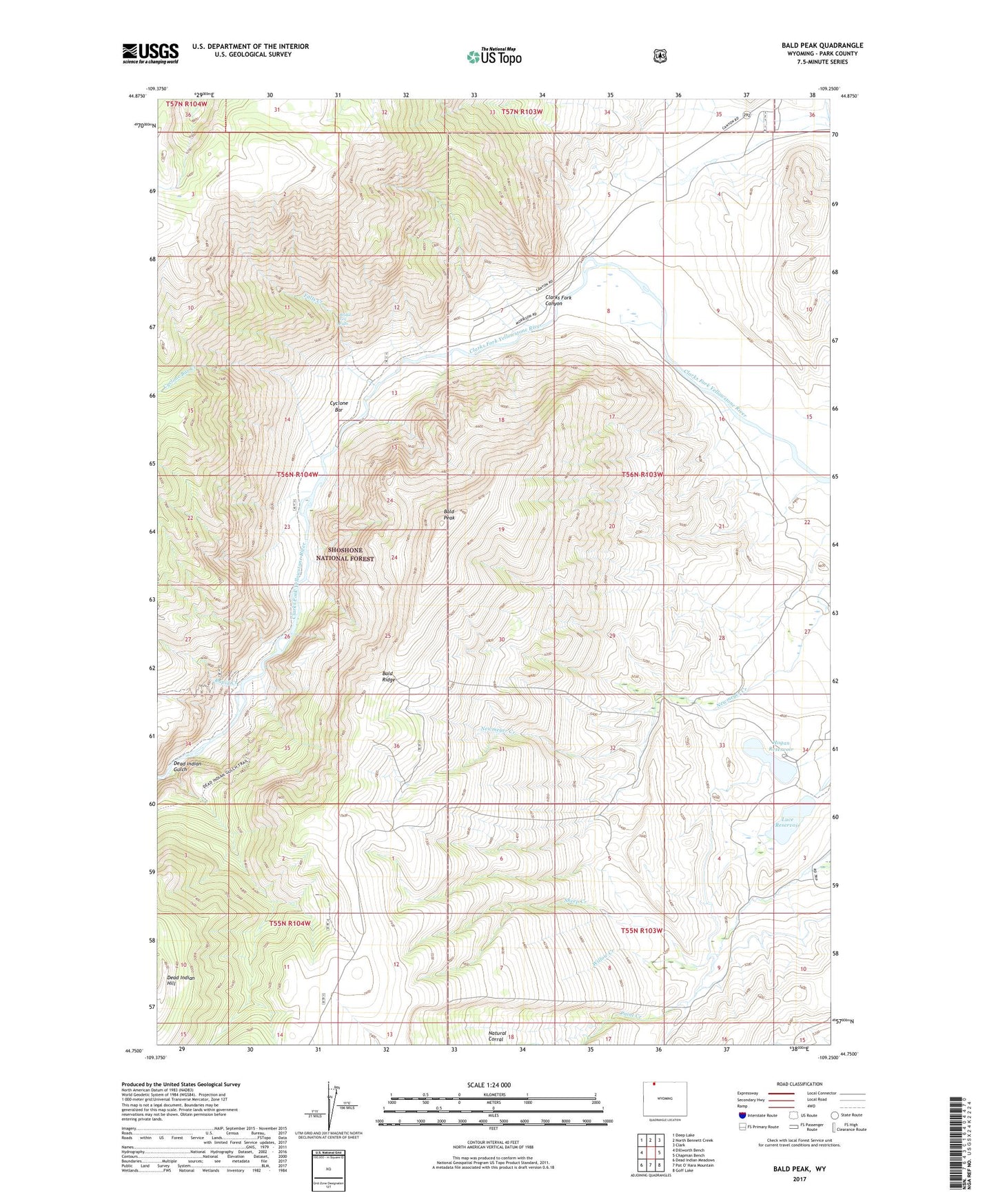
Bald Peak Wyoming US Topo Map
Couldn't load pickup availability
Also explore the Bald Peak Forest Service Topo of this same quad for updated USFS data
2021 topographic map quadrangle Bald Peak in the state of Wyoming. Scale: 1:24000. Based on the newly updated USGS 7.5' US Topo map series, this map is in the following counties: Park. The map contains contour data, water features, and other items you are used to seeing on USGS maps, but also has updated roads and other features. This is the next generation of topographic maps. Printed on high-quality waterproof paper with UV fade-resistant inks.
Quads adjacent to this one:
West: Dillworth Bench
Northwest: Deep Lake
North: North Bennett Creek
Northeast: Clark
East: Chapman Bench
Southeast: Goff Lake
Southwest: Dead Indian Meadows
This map covers the same area as the classic USGS quad with code o44109g3.
Contains the following named places: Bakers Ranch, Bald Peak, Bald Ridge, Bridal Veil Falls, Clarks Fork Canyon, Cyclone Bar, Cyclone Bar Creek, Davidson Ranch, Dead Indian Gulch, Dead Indian Hill, Dead Indian Mine, Falls Creek, Hogan Reservoir, Luce Dam, Luce Reservoir, Martins Ranch, Rapid Creek, Sheep Creek, Waggoner Claims, Willow Creek