MyTopo
Chapman Bench Wyoming US Topo Map
Couldn't load pickup availability
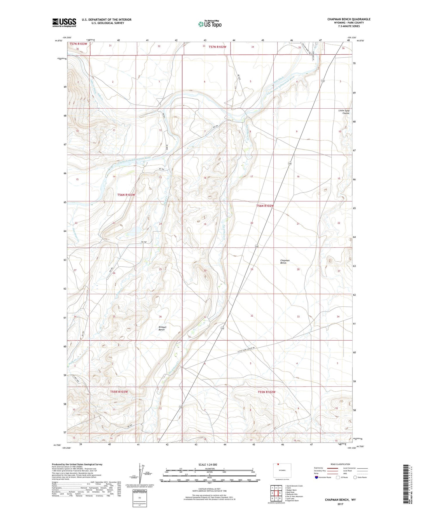
2021 topographic map quadrangle Chapman Bench in the state of Wyoming. Scale: 1:24000. Based on the newly updated USGS 7.5' US Topo map series, this map is in the following counties: Park. The map contains contour data, water features, and other items you are used to seeing on USGS maps, but also has updated roads and other features. This is the next generation of topographic maps. Printed on high-quality waterproof paper with UV fade-resistant inks.
Quads adjacent to this one:
West: Bald Peak
Northwest: North Bennett Creek
North: Clark
Northeast: Badger Basin
East: Badlands Hills
Southeast: Eaglenest Basin
South: Goff Lake
This map covers the same area as the classic USGS quad with code o44109g2.
Contains the following named places: Browns Mine, Chapman Bench, Hoff Ranch, Hopkins Dam, Hopkins Reservoir, Kimball Bench, Lake Creek, Lake Creek Ditch, Lewellen Ranch, Newmeyer Creek, Paint Creek, Paint Creek Reservoir, Paint Creek School, Pat O'Hara Creek, Tippecanoe Dam, Tippecanoe Reservoir