MyTopo
Green River Lakes Wyoming US Topo Map
Couldn't load pickup availability
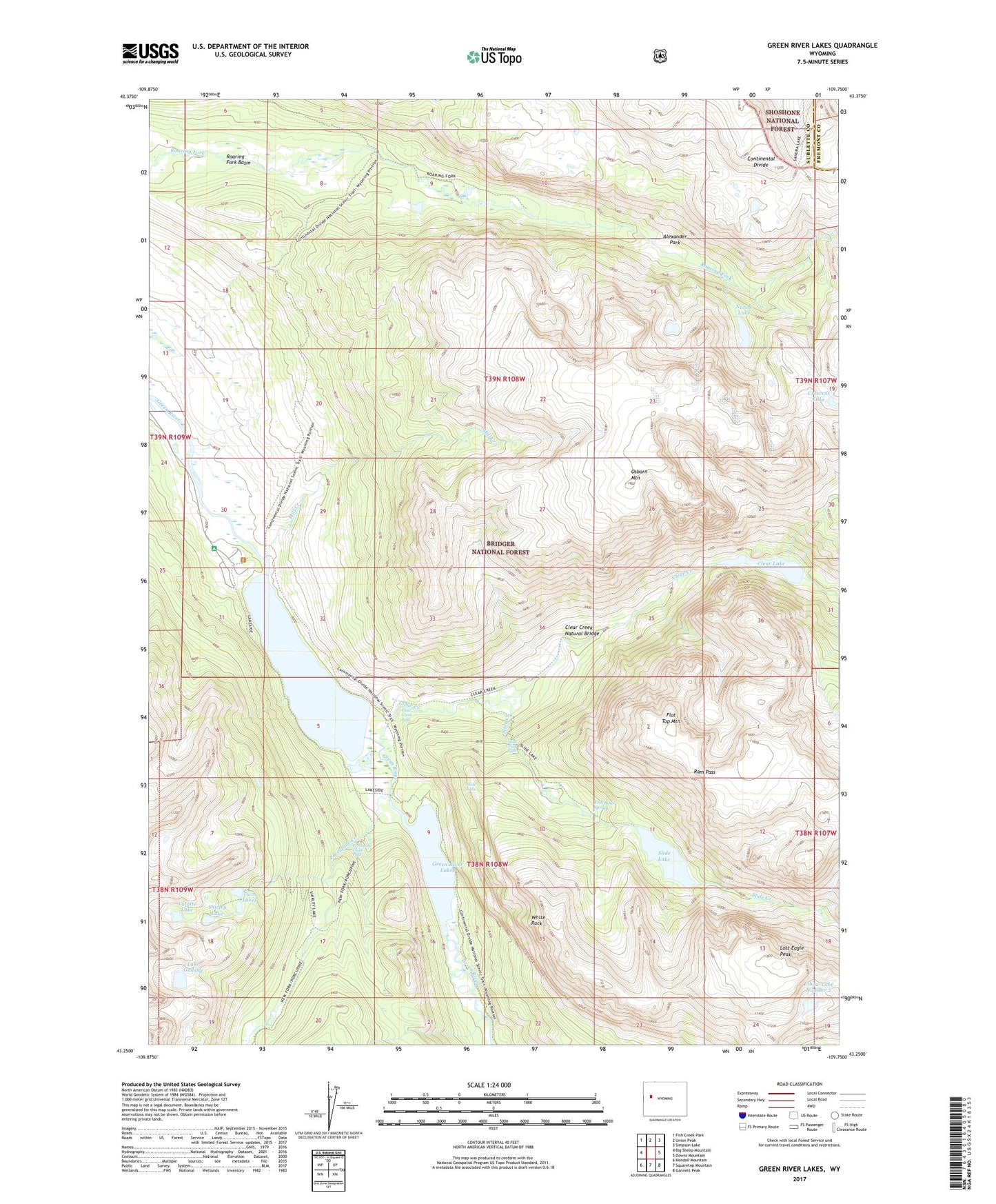
2021 topographic map quadrangle Green River Lakes in the state of Wyoming. Scale: 1:24000. Based on the newly updated USGS 7.5' US Topo map series, this map is in the following counties: Sublette, Fremont. The map contains contour data, water features, and other items you are used to seeing on USGS maps, but also has updated roads and other features. This is the next generation of topographic maps. Printed on high-quality waterproof paper with UV fade-resistant inks.
Quads adjacent to this one:
West: Big Sheep Mountain
Northwest: Fish Creek Park
North: Union Peak
Northeast: Simpson Lake
East: Downs Mountain
Southeast: Gannett Peak
South: Squaretop Mountain
Southwest: Kendall Mountain
Contains the following named places: Alexander Park, Clear Creek, Clear Creek Falls, Clear Creek Natural Bridge, Clear Creek Trail, Clear Lake, Elbow Lake Number 2, Fish Bowl Spring, Flat Top Mountain, G P Bar Ranch, Green River Lake Campground, Green River Lakes, Lake Gadsby, Lakeside Trail, Lost Eagle Peak, Mill Creek, Native Lake, Osborn Mountain, Porcupine Creek, Porcupine Creek Falls, Ram Pass, Roaring Fork Basin, Roaring Fork Trail, Shirley Lake, Slide Creek, Slide Creek Falls, Slide Falls, Slide Lake, Slide Lake Trail, Twin Lakes, Valaite Lake, White Rock