MyTopo
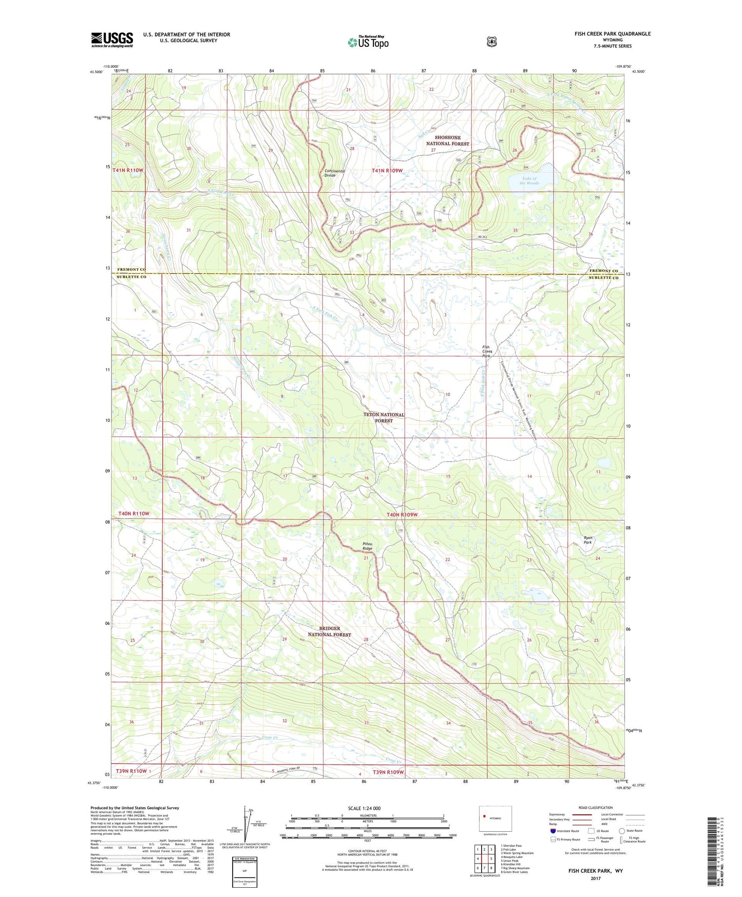
Fish Creek Park Wyoming US Topo Map
Couldn't load pickup availability
Also explore the Fish Creek Park Forest Service Topo of this same quad for updated USFS data
2021 topographic map quadrangle Fish Creek Park in the state of Wyoming. Scale: 1:24000. Based on the newly updated USGS 7.5' US Topo map series, this map is in the following counties: Sublette, Fremont. The map contains contour data, water features, and other items you are used to seeing on USGS maps, but also has updated roads and other features. This is the next generation of topographic maps. Printed on high-quality waterproof paper with UV fade-resistant inks.
Quads adjacent to this one:
West: Mosquito Lake
Northwest: Sheridan Pass
North: Fish Lake
Northeast: Warm Spring Mountain
East: Union Peak
Southeast: Green River Lakes
South: Big Sheep Mountain
Southwest: Klondike Hill
This map covers the same area as the classic USGS quad with code o43109d8.
Contains the following named places: Fish Creek Park, Grass Creek, Lake of the Woods, Lake of the Woods Trail, Mud Lake, Ryan Park, Strawberry Creek, Union Pass