MyTopo
Guernsey Reservoir Wyoming US Topo Map
Couldn't load pickup availability
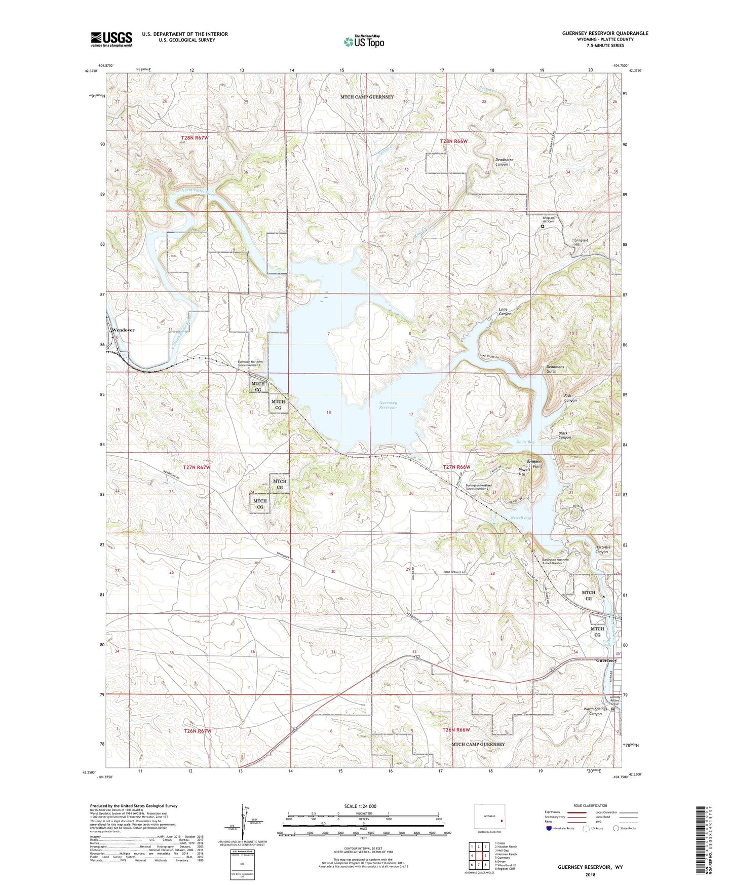
2021 topographic map quadrangle Guernsey Reservoir in the state of Wyoming. Scale: 1:24000. Based on the newly updated USGS 7.5' US Topo map series, this map is in the following counties: Platte. The map contains contour data, water features, and other items you are used to seeing on USGS maps, but also has updated roads and other features. This is the next generation of topographic maps. Printed on high-quality waterproof paper with UV fade-resistant inks.
Quads adjacent to this one:
West: Herman Ranch
Northwest: Cassa
North: Haushar Ranch
Northeast: Hell Gap
East: Guernsey
Southeast: Register Cliff
South: Wheatland NE
Southwest: Dwyer
Contains the following named places: Black Canyon, Boner Ranch, Brimmer Point, Broom Creek, Burlington Northern Tunnel Number 1, Burlington Northern Tunnel Number 2, Burlinton Northern Tunnel Number 3, Cold Spring, Cold Spring Campground, Cottonwood Creek, Davis Bay, Deadhorse Canyon, Deadmans Gulch, Emigrant Hill, Emigrant Hill Cemetery, Fish Canyon, Frederick Ranch, Guernsey Dam, Guernsey Reservoir, Guernsey Stone Quarry, Hartville Canyon, Long Canyon, LT Sisson Dolomite Deposit, Lucindy Rollins Grave, Newell Bay, Powell Mountain, Red Cloud Picnic Ground, Spotted Tail Picnic Ground, Spring Creek, Stokes Siding, Sudbury Ranch, Warm Springs Canyon, Wendover, Wendover Bend Ranch, West Ranch, ZIP Code: 82214