MyTopo
Guernsey Wyoming US Topo Map
Couldn't load pickup availability
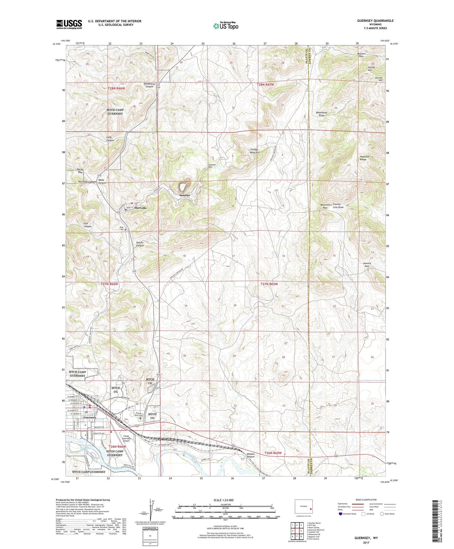
2021 topographic map quadrangle Guernsey in the state of Wyoming. Scale: 1:24000. Based on the newly updated USGS 7.5' US Topo map series, this map is in the following counties: Platte, Goshen. The map contains contour data, water features, and other items you are used to seeing on USGS maps, but also has updated roads and other features. This is the next generation of topographic maps. Printed on high-quality waterproof paper with UV fade-resistant inks.
Quads adjacent to this one:
West: Guernsey Reservoir
Northwest: Haushar Ranch
North: Hell Gap
Northeast: Moore Spring
East: Casebier Hill
Southeast: Fort Laramie
South: Register Cliff
Southwest: Wheatland NE
This map covers the same area as the classic USGS quad with code o42104c6.
Contains the following named places: Bohnstead Draw, Boot Hill Cemetery, Camp Guernsey, Camp Guernsey Airport, Camp Guernsey Fire Department, Chicago Mine, Chicago Mine Hill, Crane, Frederick Ranch, Garnet Hill, Good Fortune Mine, Graves Ranch, Guernsey, Guernsey Fish Pond, Guernsey Fish Pond Dam, Guernsey Police Department, Guernsey Post Office, Guernsey Rural Fire District, Guernsey Volunteer Fire Department, Guernsey-Sunrise High School, Guernsey-Sunrise Junior High School, Guernsey-Sunrise School, Hartville, Hartville Fire Department, Hartville Post Office, Haystack Range, Ingleside Quarries, Jehosophat Prospect, Lauk-stein Ruins, McCann Pass, McGinnis Pass, New York Prospect, Pete Kiewit and Sons Mine, Prairie Rest Cemetery, Rocky Pass, Ross Ranch, Ruth Prospect, Seward Pass, Sparks Canyon, Sunrise, Sunrise Hill, Sunrise Mine, Torrington Number One Mine, Town of Guernsey, Town of Hartville, Webb Canyon, Whalen Canyon, White Star Prospect