MyTopo
Hells Half Acre Wyoming US Topo Map
Couldn't load pickup availability
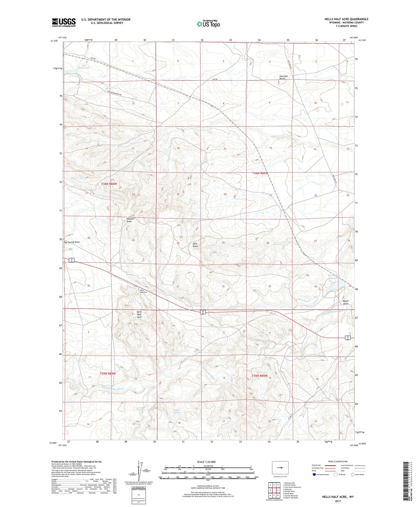
2021 topographic map quadrangle Hells Half Acre in the state of Wyoming. Scale: 1:24000. Based on the newly updated USGS 7.5' US Topo map series, this map is in the following counties: Natrona. The map contains contour data, water features, and other items you are used to seeing on USGS maps, but also has updated roads and other features. This is the next generation of topographic maps. Printed on high-quality waterproof paper with UV fade-resistant inks.
Quads adjacent to this one:
West: Waltman
Northwest: Waltman NW
North: Notches Dome
Northeast: Cave Gulch Reservoir
East: Powder River
Southeast: Square Top Butte
South: Gaylord Reservoir
Southwest: Broad Mesa
This map covers the same area as the classic USGS quad with code o43107a1.
Contains the following named places: Boone Dome Gas Field, Burlington Reservoir, Hells Half Acre, Lox Dam, Lox Reservoir, Shirttail Butte, Sulfur Springs, T E C Dam, Wallace Creek, Wyatt Draw