MyTopo
Powder River Wyoming US Topo Map
Couldn't load pickup availability
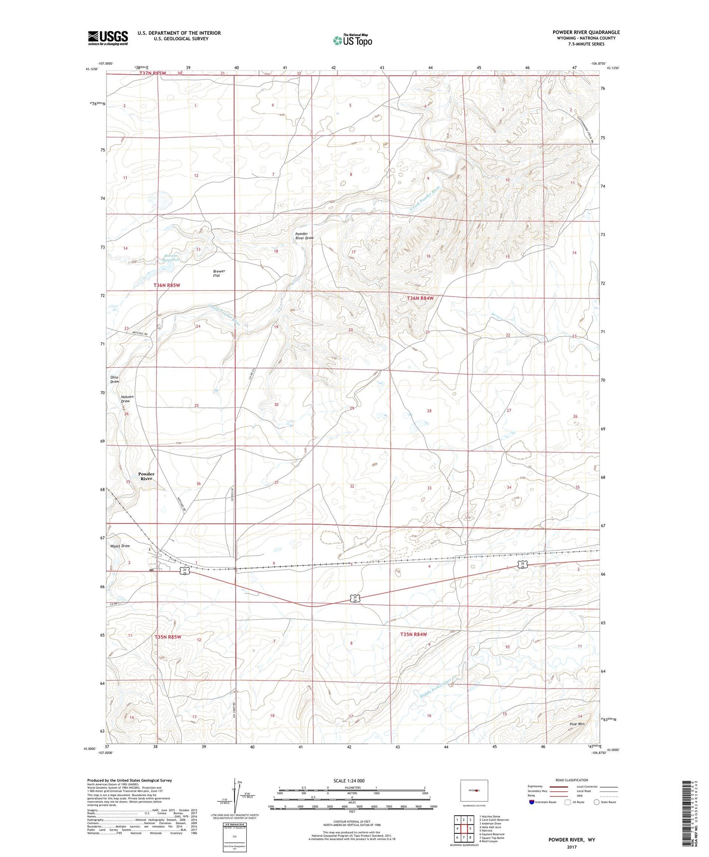
2021 topographic map quadrangle Powder River in the state of Wyoming. Scale: 1:24000. Based on the newly updated USGS 7.5' US Topo map series, this map is in the following counties: Natrona. The map contains contour data, water features, and other items you are used to seeing on USGS maps, but also has updated roads and other features. This is the next generation of topographic maps. Printed on high-quality waterproof paper with UV fade-resistant inks.
Quads adjacent to this one:
West: Hells Half Acre
Northwest: Notches Dome
North: Cave Gulch Reservoir
Northeast: Anderson Draw
East: Natrona
Southeast: Reid Canyon
South: Square Top Butte
Southwest: Gaylord Reservoir
This map covers the same area as the classic USGS quad with code o43106a8.
Contains the following named places: Brewer Dam, Brewer Flat, Brewer Reservoir, Burke Dam, Burke Reservoir, Clark Place Well, Hohnen Draw, Ohio Draw, Powder River, Powder River Census Designated Place, Powder River Draw, Powder River Elementary School, Powder River Mine, Powder River Post Office