MyTopo
Hulett Wyoming US Topo Map
Couldn't load pickup availability
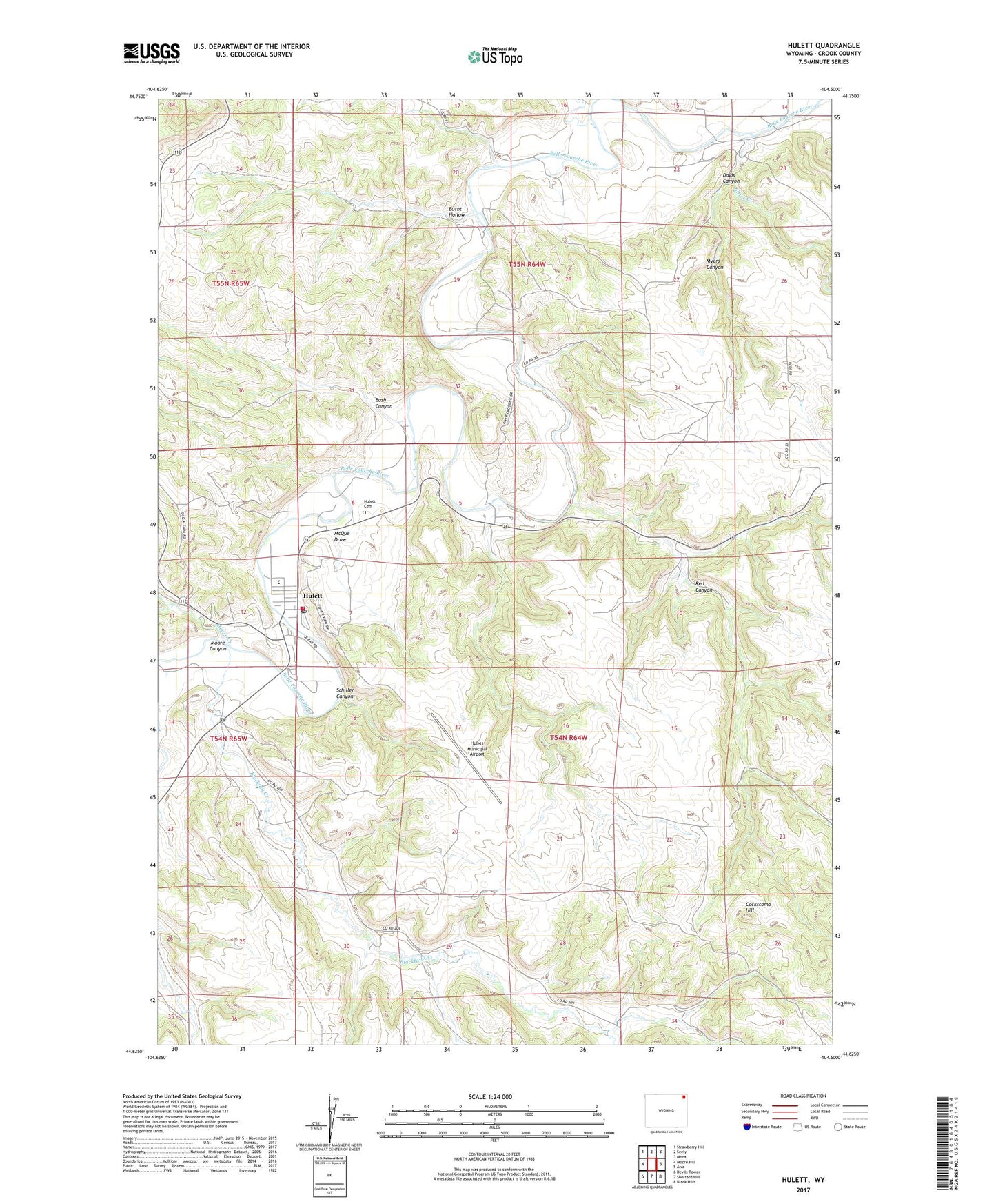
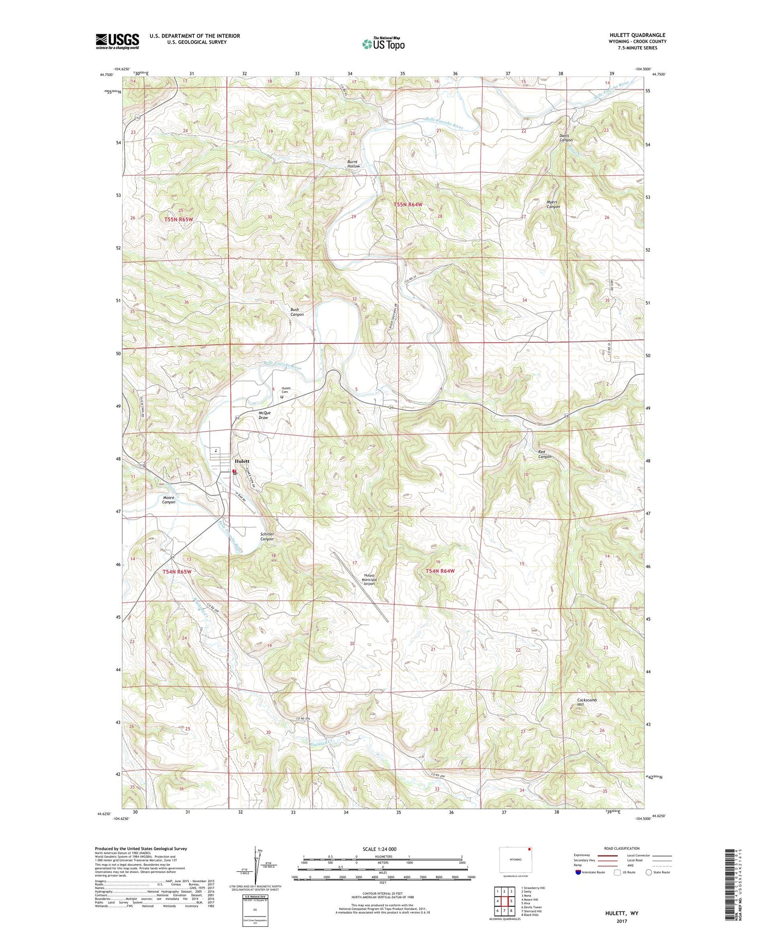
2021 topographic map quadrangle Hulett in the state of Wyoming. Scale: 1:24000. Based on the newly updated USGS 7.5' US Topo map series, this map is in the following counties: Crook. The map contains contour data, water features, and other items you are used to seeing on USGS maps, but also has updated roads and other features. This is the next generation of topographic maps. Printed on high-quality waterproof paper with UV fade-resistant inks.
Quads adjacent to this one:
West: Moore Hill
Northwest: Strawberry Hill
North: Seely
Northeast: Mona
East: Alva
Southeast: Black Hills
South: Sherrard Hill
Southwest: Devils Tower
Contains the following named places: Beaver Creek Mine, Bitter Creek, Blacktail Creek, Burnt Hollow, Bush Canyon, Cockscomb Hill, Cotton School, Davis Canyon, Dirks School, Homestake School, Hulett, Hulett Cemetery, Hulett Emergency Medical Services, Hulett High School, Hulett Junior High School, Hulett Municipal Airport, Hulett Post Office, Hulett School, Hulett Volunteer Fire Department, McQue Draw, Moore Canyon, Moore Creek, Myers Canyon, Red Canyon, Schiller Canyon, Sourdough Creek, Town of Hulett, Whitetail Creek, Wilson School