MyTopo
Indian Guide Wyoming US Topo Map
Couldn't load pickup availability
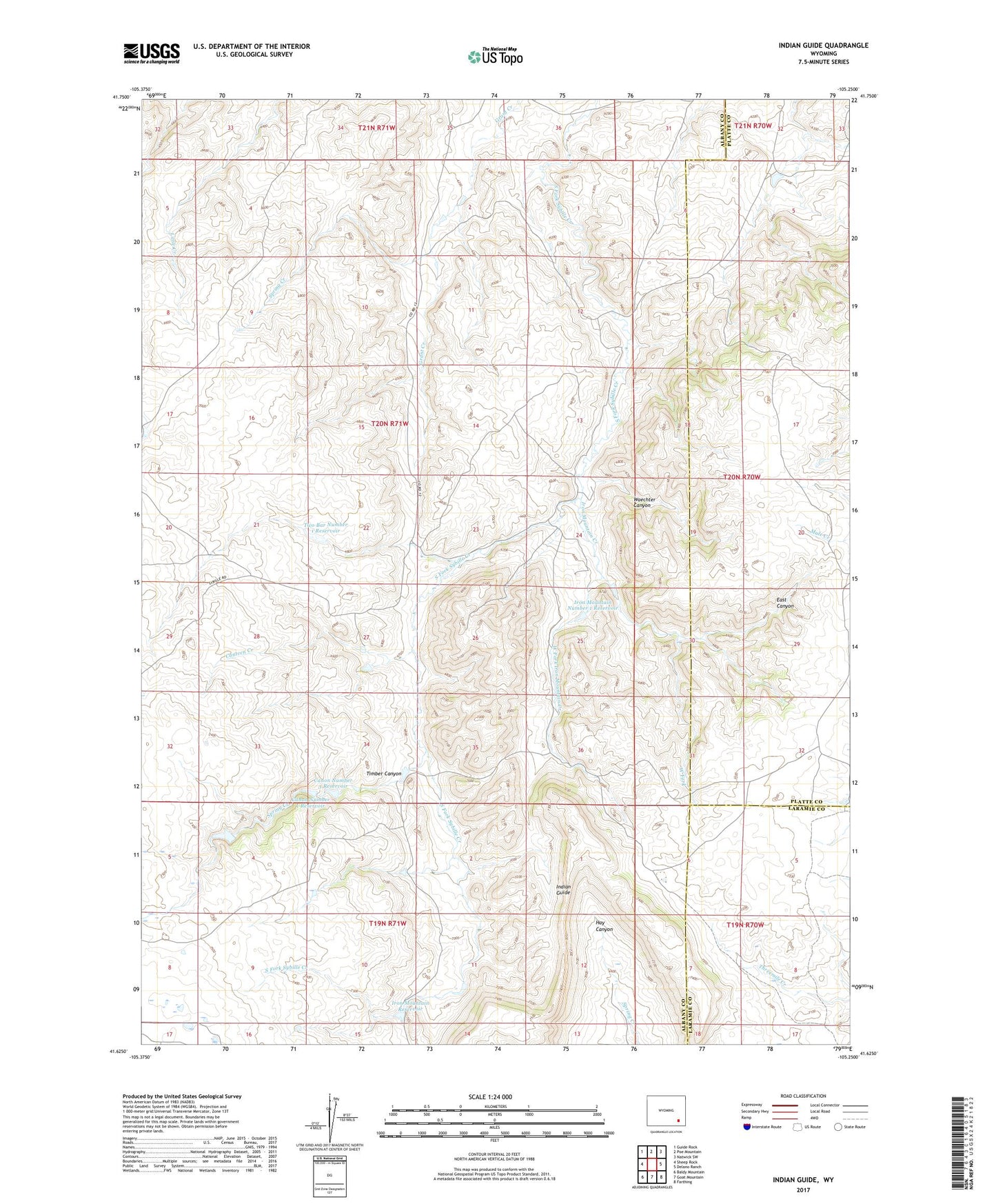
2021 topographic map quadrangle Indian Guide in the state of Wyoming. Scale: 1:24000. Based on the newly updated USGS 7.5' US Topo map series, this map is in the following counties: Albany, Platte, Laramie. The map contains contour data, water features, and other items you are used to seeing on USGS maps, but also has updated roads and other features. This is the next generation of topographic maps. Printed on high-quality waterproof paper with UV fade-resistant inks.
Quads adjacent to this one:
West: Sheep Rock
Northwest: Guide Rock
North: Poe Mountain
Northeast: Natwick SW
East: Delano Ranch
Southeast: Farthing
South: Goat Mountain
Southwest: Baldy Mountain
This map covers the same area as the classic USGS quad with code o41105f3.
Contains the following named places: Canon Number 1 Dam, Canon Number 1 Reservoir, Canon Number 2 Dam, Canon Number 2 Reservoir, Canon Number 3 Dam, Canon Number 3 Reservoir, Canon Number 4 Dam, Canon Number 4 Reservoir, Canteen Creek, East Canyon, Indian Guide, Iron Mountain Creek, Iron Mountain Dam, Iron Mountain Number 1 Dam, Iron Mountain Number 1 Reservoir, Iron Mountain Reservoir, Shaffer School, South Sybille School, Spring Creek, Taylor Deposit, Timber Canyon, Two Bar Creek, Two Bar Number 1 Dam, Two Bar Number 1 Reservoir, Waechter Canyon, West Fork, West Fork Iron Mountain Creek