MyTopo
Indian Point Wyoming US Topo Map
Couldn't load pickup availability
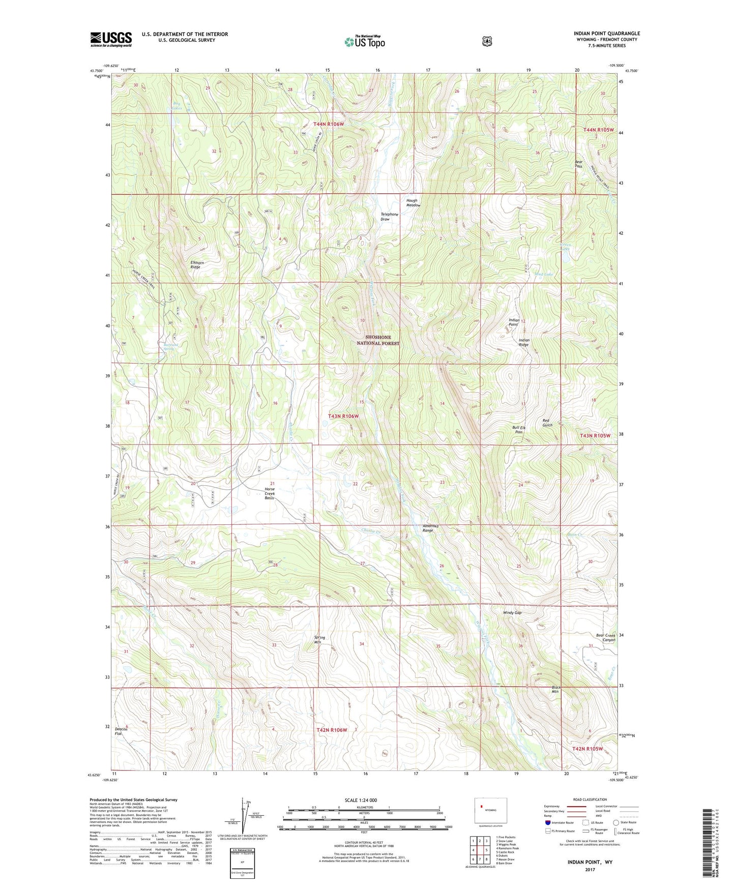
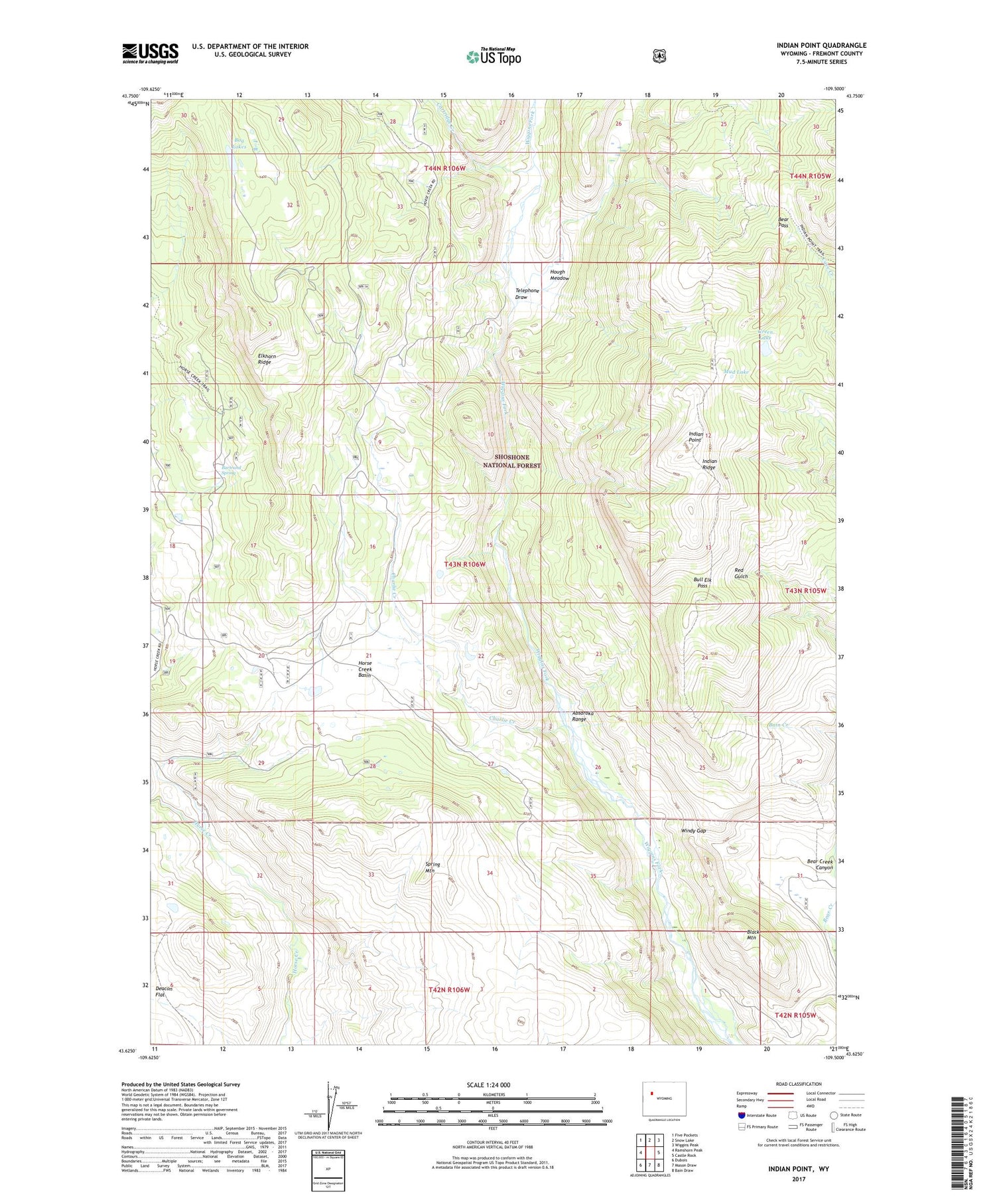
2021 topographic map quadrangle Indian Point in the state of Wyoming. Scale: 1:24000. Based on the newly updated USGS 7.5' US Topo map series, this map is in the following counties: Fremont. The map contains contour data, water features, and other items you are used to seeing on USGS maps, but also has updated roads and other features. This is the next generation of topographic maps. Printed on high-quality waterproof paper with UV fade-resistant inks.
Quads adjacent to this one:
West: Ramshorn Peak
Northwest: Five Pockets
North: Snow Lake
Northeast: Wiggins Peak
East: Castle Rock
Southeast: Bain Draw
South: Mason Draw
Southwest: Dubois
Contains the following named places: Bain Cabin, Bartrand Spring, Bear Pass, Beck Cow Camp, Black Mountain, Bog Lakes, Boundary Trail, Bull Elk Pass, Cartridge Creek, Charlie Creek, East Fork Elk Winter Pasture Headquarters, Eastman Place, Elkhorn Ridge, Green Lake, High Acres Ranch, Horse Creek Basin, Hough Cabin, Hough Meadow, Indian Point, Indian Point Trail, Indian Ridge, Livingston Cabin, Mud Lake, Rocking Chair Cow Camp, Simmerson Place, Spring Draw, Spring Mountain, Spring Mountain Cow Camp, Telephone Draw, Windy Gap