MyTopo
Ramshorn Peak Wyoming US Topo Map
Couldn't load pickup availability
Also explore the Ramshorn Peak Forest Service Topo of this same quad for updated USFS data
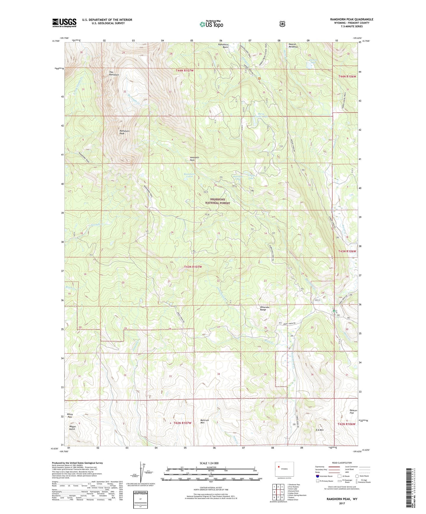
2021 topographic map quadrangle Ramshorn Peak in the state of Wyoming. Scale: 1:24000. Based on the newly updated USGS 7.5' US Topo map series, this map is in the following counties: Fremont. The map contains contour data, water features, and other items you are used to seeing on USGS maps, but also has updated roads and other features. This is the next generation of topographic maps. Printed on high-quality waterproof paper with UV fade-resistant inks.
Quads adjacent to this one:
West: Esmond Park
Northwest: Shoshone Pass
North: Five Pockets
Northeast: Snow Lake
East: Indian Point
Southeast: Mason Draw
South: Dubois
Southwest: Warm Spring Mountain
This map covers the same area as the classic USGS quad with code o43109f6.
Contains the following named places: Adams Ranch, Amoretti Park, Battrum Mountain, Brent Creek, Burnt Timber Lake, Burroughs Creek, Burroughs Creek Trail, Carson Lake, Deacon Flat, Deacon Meadows, E A Mountain, Fisher Tie Camp, Horse Creek Ranger Station, Houg Ranch, Parque Creek, Parque Creek Trail, Rainbow Lake, Ramshorn Basin, Ramshorn Lakes, Ramshorn Peak, Ramshorn Trail, T Cross Ranch, Utzinger Ranch, Virgin Lake, White Pass, ZIP Code: 82513