MyTopo
Joe Emge Creek Wyoming US Topo Map
Couldn't load pickup availability
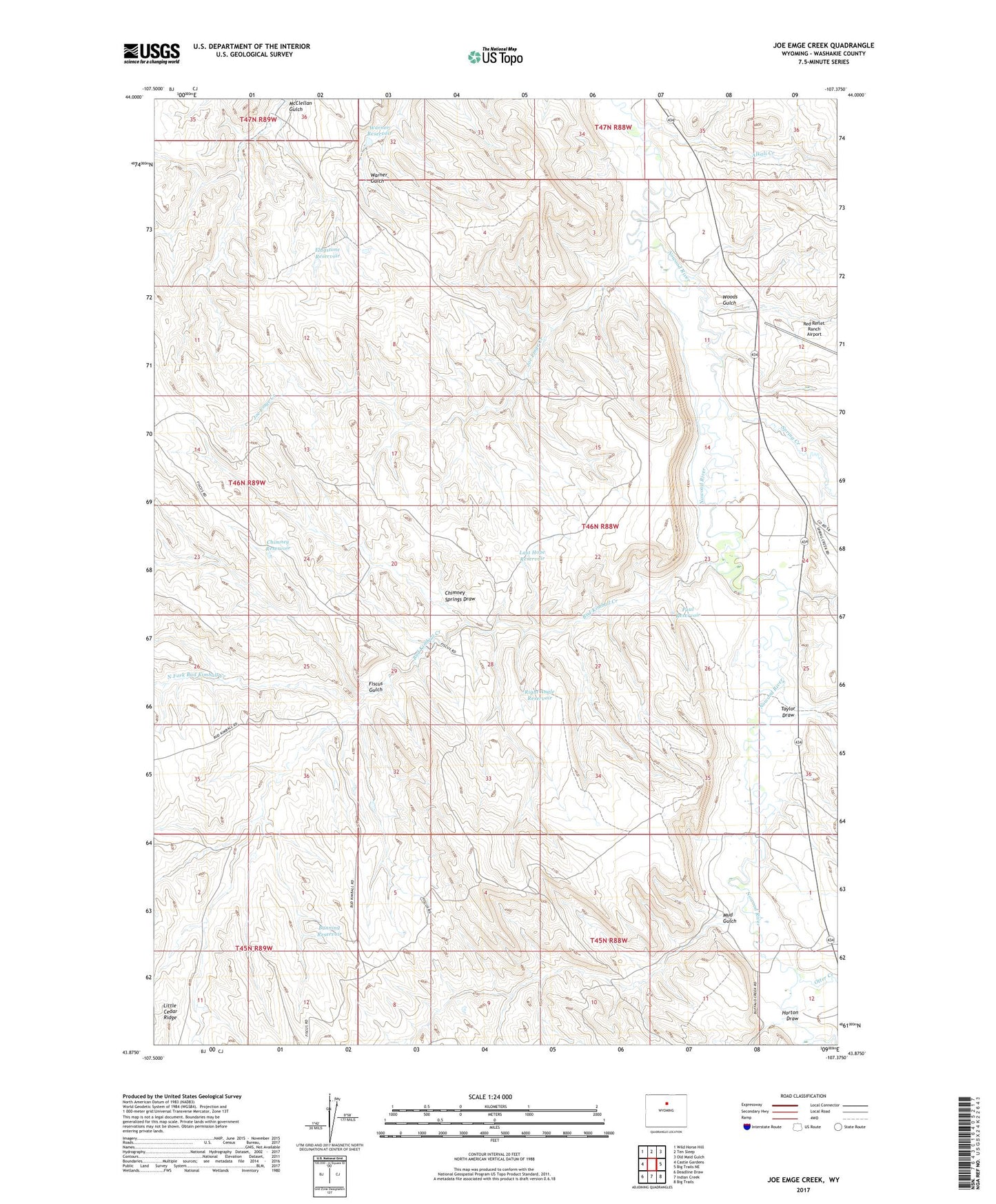
2021 topographic map quadrangle Joe Emge Creek in the state of Wyoming. Scale: 1:24000. Based on the newly updated USGS 7.5' US Topo map series, this map is in the following counties: Washakie. The map contains contour data, water features, and other items you are used to seeing on USGS maps, but also has updated roads and other features. This is the next generation of topographic maps. Printed on high-quality waterproof paper with UV fade-resistant inks.
Quads adjacent to this one:
West: Castle Gardens
Northwest: Wild Horse Hill
North: Ten Sleep
Northeast: Old Maid Gulch
East: Big Trails NE
Southeast: Big Trails
South: Indian Creek
Southwest: Deadline Draw
Contains the following named places: Alkali Creek, Bud Kimball Creek, Bud Kimball Creek Mine, Bunning Reservoir, Chimney Reservoir, Chimney Springs Draw, Dugout Creek Deposit, Extended Breer Number Two Mine, Fiscus Gulch, Flagstone Reservoir, Horton Draw, Joe Emge Creek, Last Hope Reservoir, Mud Gulch, North Fork Bud Kimball Creek, Otter Creek, Paul Reservoir, Red Reflet Ranch Airport, Right Angle Reservoir, Spring Creek, Taylor Draw, Warner Reservoir, Woods Gulch