MyTopo
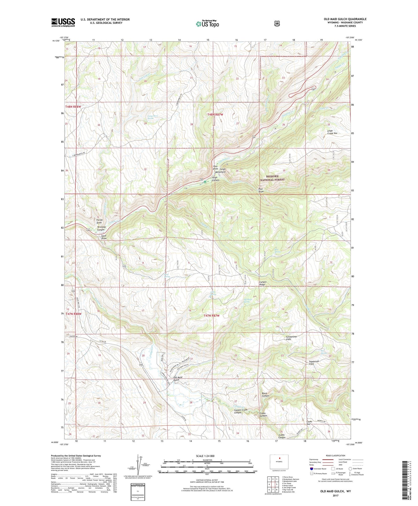
Old Maid Gulch Wyoming US Topo Map
Couldn't load pickup availability
Also explore the Old Maid Gulch Forest Service Topo of this same quad for updated USFS data
2023 topographic map quadrangle Old Maid Gulch in the state of Wyoming. Scale: 1:24000. Based on the newly updated USGS 7.5' US Topo map series, this map is in the following counties: Washakie. The map contains contour data, water features, and other items you are used to seeing on USGS maps, but also has updated roads and other features. This is the next generation of topographic maps. Printed on high-quality waterproof paper with UV fade-resistant inks.
Quads adjacent to this one:
West: Ten Sleep
Northwest: Pierce Draw
North: Brokenback Narrows
Northeast: Meadowlark Lake
East: Onion Gulch
Southeast: Monument Hill
South: Big Trails NE
Southwest: Joe Emge Creek
This map covers the same area as the classic USGS quad with code o44107a3.
Contains the following named places: Big Spring, Black Canyon, Cabin Spring, Camp Stove Spring, Canyon Creek Canyon, Canyon Lodge, Childs Creek, Circle J Ranch, Cooks Canyon, Daugherty Pit, Davis Number One Pit, Dry Tensleep Creek, Fertig Draw, Leigh Canyon, Leigh Creek, Leigh Creek Campground, Leigh Creek Vee, Leigh Monument, Old Maid Gulch, Old Maid Spring, Post Draw, Rice Spring, Sagebrush Flats, Salt Lick Creek, Sand Draw, Sand Spring, Schoonover Flats, Squaw Creek, Tensleep Campground, Tensleep Canyon, Tensleep Canyon Mine, Tensleep Fish Hatchery, Tepee Creek, Tomis Pit, Williams Mill