MyTopo
Johnson Ranch Wyoming US Topo Map
Couldn't load pickup availability
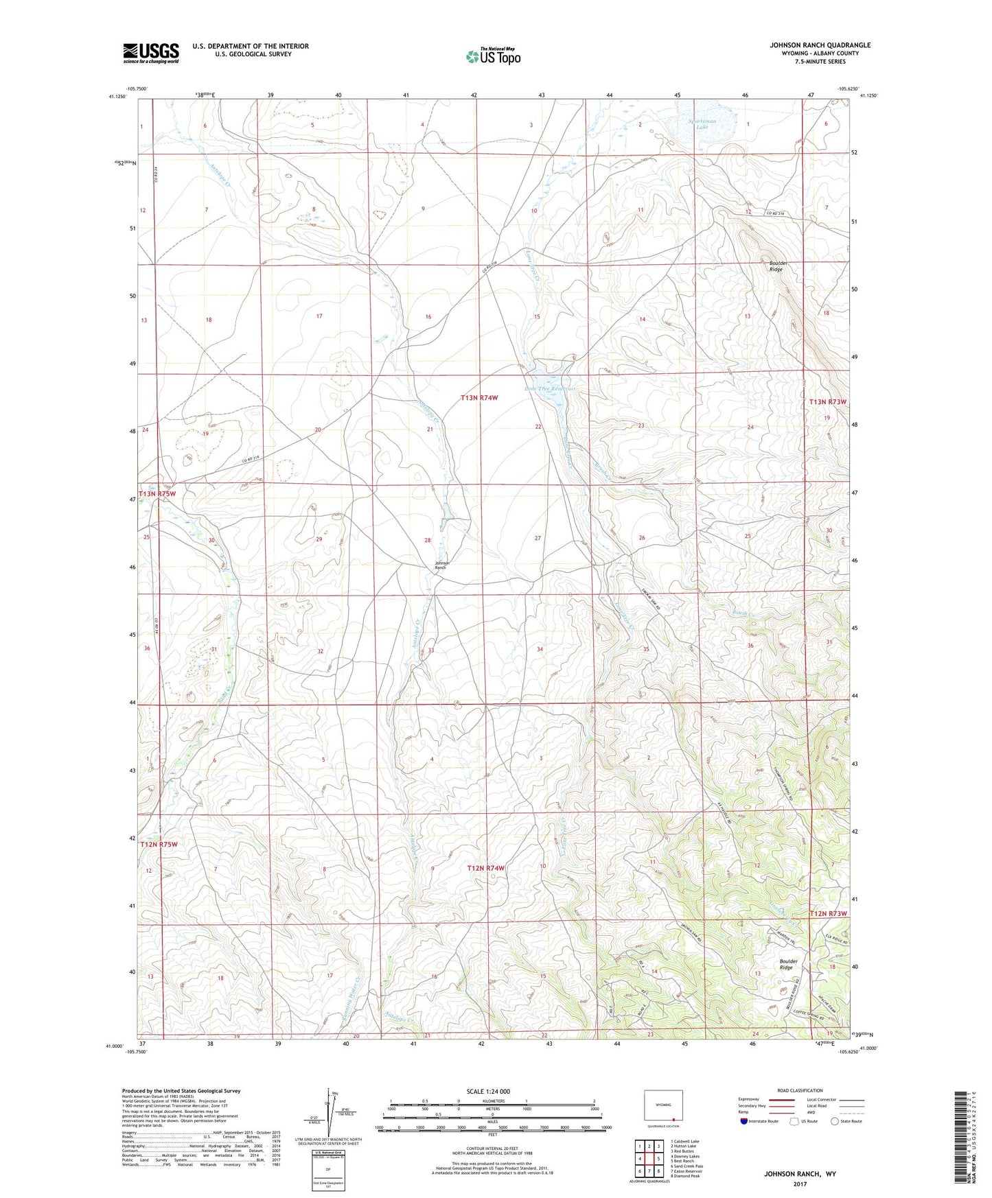
2021 topographic map quadrangle Johnson Ranch in the state of Wyoming. Scale: 1:24000. Based on the newly updated USGS 7.5' US Topo map series, this map is in the following counties: Albany. The map contains contour data, water features, and other items you are used to seeing on USGS maps, but also has updated roads and other features. This is the next generation of topographic maps. Printed on high-quality waterproof paper with UV fade-resistant inks.
Quads adjacent to this one:
West: Downey Lakes
Northwest: Caldwell Lake
North: Hutton Lake
Northeast: Red Buttes
East: Best Ranch
Southeast: Diamond Peak
South: Eaton Reservoir
Southwest: Sand Creek Pass
Contains the following named places: Brush Creek, Chimney Rock Ranch, Five Mile Ranch, Gooseberry Creek, Johnson Ranch, Lone Tree Dam, Lone Tree Reservoir, Running Water Creek, Sand Creek School, Sportsman Lake